You are here: Home > Network List > TA - USArray Transportable Network (new EarthScope stations) Stations List
> Station C16K Lisburne Hills, AK, USA > Earthquake Result Viewer
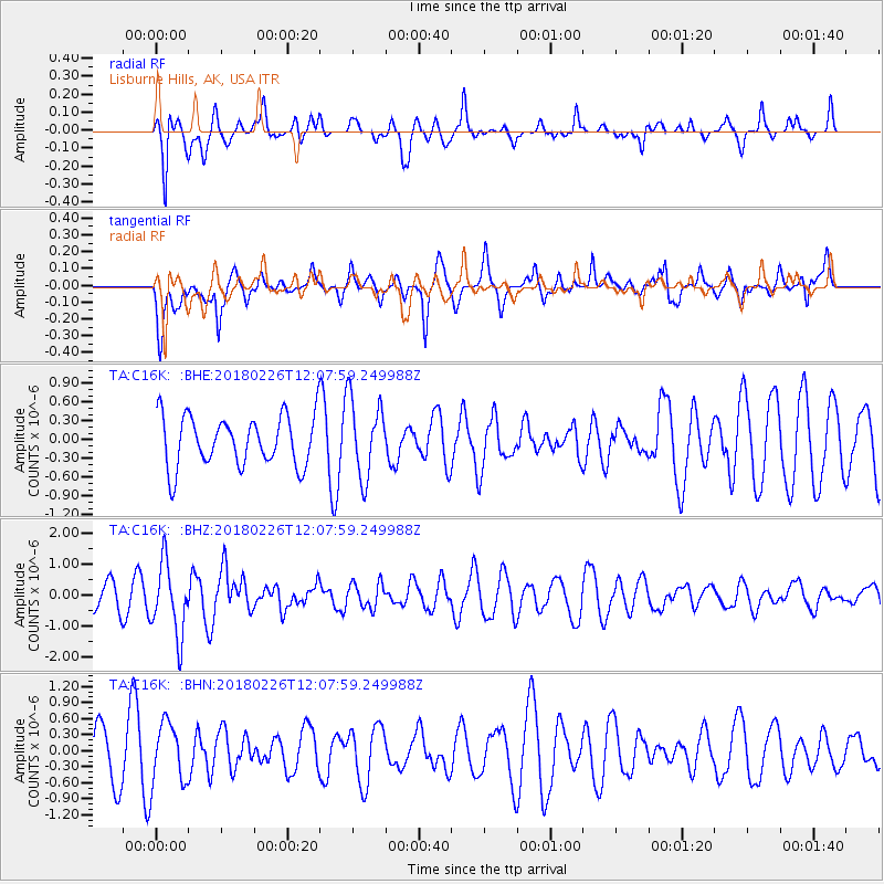
C16K Lisburne Hills, AK, USA - Earthquake Result Viewer
*The percent match for this event was below the threshold and hence no stack was calculated.
| Earthquake location: |
New Guinea, Papua New Guinea |
| Earthquake latitude/longitude: |
-6.5/143.6 |
| Earthquake time(UTC): |
2018/02/26 (057) 11:56:07 GMT |
| Earthquake Depth: |
13 km |
| Earthquake Magnitude: |
5.7 Mww |
| Earthquake Catalog/Contributor: |
NEIC PDE/us |
|
| Network: |
TA USArray Transportable Network (new EarthScope stations) |
| Station: |
C16K Lisburne Hills, AK, USA |
| Lat/Lon: |
68.27 N/165.34 W |
| Elevation: |
102 m |
|
| Distance: |
82.7 deg |
| Az: |
16.987 deg |
| Baz: |
231.237 deg |
| Ray Param: |
$rayparam |
*The percent match for this event was below the threshold and hence was not used in the summary stack. |
|
| Radial Match: |
70.51005 % |
| Radial Bump: |
335 |
| Transverse Match: |
52.278126 % |
| Transverse Bump: |
400 |
| SOD ConfigId: |
13570011 |
| Insert Time: |
2019-04-29 20:58:10.489 +0000 |
| GWidth: |
2.5 |
| Max Bumps: |
400 |
| Tol: |
0.001 |
|
Signal To Noise
| Channel | StoN | STA | LTA |
| TA:C16K: :BHZ:20180226T12:07:59.249988Z | 2.506222 | 1.1540144E-6 | 4.6045974E-7 |
| TA:C16K: :BHN:20180226T12:07:59.249988Z | 1.0824085 | 5.6813076E-7 | 5.2487644E-7 |
| TA:C16K: :BHE:20180226T12:07:59.249988Z | 1.6289493 | 6.401135E-7 | 3.92961E-7 |
| Arrivals |
| Ps | |
| PpPs | |
| PsPs/PpSs | |


