You are here: Home > Network List > TA - USArray Transportable Network (new EarthScope stations) Stations List
> Station J26L Joseph Creek, AK, USA > Earthquake Result Viewer
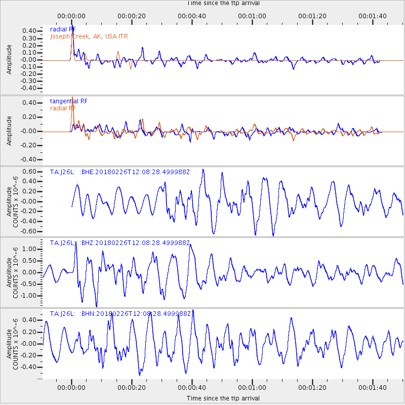
J26L Joseph Creek, AK, USA - Earthquake Result Viewer
*The percent match for this event was below the threshold and hence no stack was calculated.
| Earthquake location: |
New Guinea, Papua New Guinea |
| Earthquake latitude/longitude: |
-6.5/143.6 |
| Earthquake time(UTC): |
2018/02/26 (057) 11:56:07 GMT |
| Earthquake Depth: |
13 km |
| Earthquake Magnitude: |
5.7 Mww |
| Earthquake Catalog/Contributor: |
NEIC PDE/us |
|
| Network: |
TA USArray Transportable Network (new EarthScope stations) |
| Station: |
J26L Joseph Creek, AK, USA |
| Lat/Lon: |
64.50 N/143.56 W |
| Elevation: |
1144 m |
|
| Distance: |
88.6 deg |
| Az: |
24.444 deg |
| Baz: |
251.795 deg |
| Ray Param: |
$rayparam |
*The percent match for this event was below the threshold and hence was not used in the summary stack. |
|
| Radial Match: |
55.347435 % |
| Radial Bump: |
400 |
| Transverse Match: |
55.5742 % |
| Transverse Bump: |
400 |
| SOD ConfigId: |
13570011 |
| Insert Time: |
2019-04-29 20:58:43.420 +0000 |
| GWidth: |
2.5 |
| Max Bumps: |
400 |
| Tol: |
0.001 |
|
Signal To Noise
| Channel | StoN | STA | LTA |
| TA:J26L: :BHZ:20180226T12:08:28.499988Z | 3.390715 | 6.3992013E-7 | 1.8872721E-7 |
| TA:J26L: :BHN:20180226T12:08:28.499988Z | 0.44764438 | 1.05076694E-7 | 2.3473252E-7 |
| TA:J26L: :BHE:20180226T12:08:28.499988Z | 1.6196475 | 2.742214E-7 | 1.6930932E-7 |
| Arrivals |
| Ps | |
| PpPs | |
| PsPs/PpSs | |


