You are here: Home > Network List > TA - USArray Transportable Network (new EarthScope stations) Stations List
> Station U33K Whale Pass, AK, USA > Earthquake Result Viewer
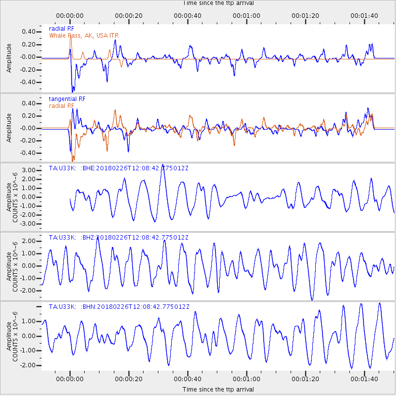
U33K Whale Pass, AK, USA - Earthquake Result Viewer
*The percent match for this event was below the threshold and hence no stack was calculated.
| Earthquake location: |
New Guinea, Papua New Guinea |
| Earthquake latitude/longitude: |
-6.5/143.6 |
| Earthquake time(UTC): |
2018/02/26 (057) 11:56:07 GMT |
| Earthquake Depth: |
13 km |
| Earthquake Magnitude: |
5.7 Mww |
| Earthquake Catalog/Contributor: |
NEIC PDE/us |
|
| Network: |
TA USArray Transportable Network (new EarthScope stations) |
| Station: |
U33K Whale Pass, AK, USA |
| Lat/Lon: |
56.11 N/133.12 W |
| Elevation: |
11 m |
|
| Distance: |
91.6 deg |
| Az: |
33.817 deg |
| Baz: |
260.867 deg |
| Ray Param: |
$rayparam |
*The percent match for this event was below the threshold and hence was not used in the summary stack. |
|
| Radial Match: |
58.372143 % |
| Radial Bump: |
400 |
| Transverse Match: |
56.855778 % |
| Transverse Bump: |
400 |
| SOD ConfigId: |
13570011 |
| Insert Time: |
2019-04-29 20:59:03.398 +0000 |
| GWidth: |
2.5 |
| Max Bumps: |
400 |
| Tol: |
0.001 |
|
Signal To Noise
| Channel | StoN | STA | LTA |
| TA:U33K: :BHZ:20180226T12:08:42.775012Z | 0.65325946 | 7.904317E-7 | 1.2099813E-6 |
| TA:U33K: :BHN:20180226T12:08:42.775012Z | 0.9847479 | 7.2362445E-7 | 7.348322E-7 |
| TA:U33K: :BHE:20180226T12:08:42.775012Z | 1.9699792 | 2.1889289E-6 | 1.1111432E-6 |
| Arrivals |
| Ps | |
| PpPs | |
| PsPs/PpSs | |


