You are here: Home > Network List > TA - USArray Transportable Network (new EarthScope stations) Stations List
> Station 109C Camp Elliot, Mirimar, CA, USA > Earthquake Result Viewer
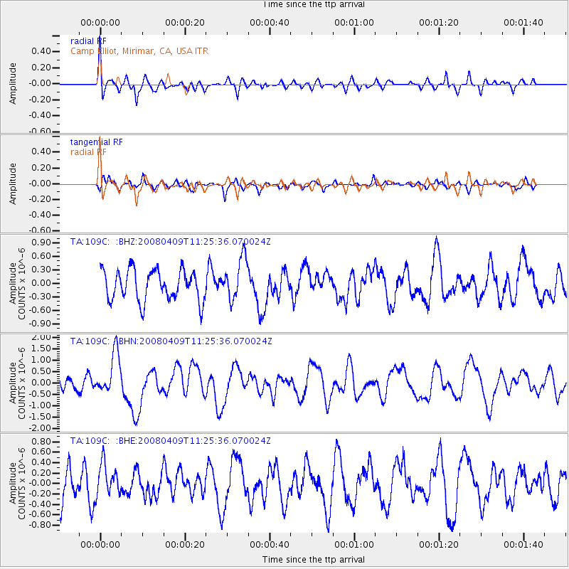
109C Camp Elliot, Mirimar, CA, USA - Earthquake Result Viewer
*The percent match for this event was below the threshold and hence no stack was calculated.
| Earthquake location: |
Loyalty Islands |
| Earthquake latitude/longitude: |
-20.2/168.9 |
| Earthquake time(UTC): |
2008/04/09 (100) 11:13:17 GMT |
| Earthquake Depth: |
13 km |
| Earthquake Magnitude: |
5.6 MB, 6.3 MS, 6.4 MW, 6.3 MW |
| Earthquake Catalog/Contributor: |
WHDF/NEIC |
|
| Network: |
TA USArray Transportable Network (new EarthScope stations) |
| Station: |
109C Camp Elliot, Mirimar, CA, USA |
| Lat/Lon: |
32.89 N/117.11 W |
| Elevation: |
150 m |
|
| Distance: |
88.2 deg |
| Az: |
54.032 deg |
| Baz: |
244.638 deg |
| Ray Param: |
$rayparam |
*The percent match for this event was below the threshold and hence was not used in the summary stack. |
|
| Radial Match: |
66.21646 % |
| Radial Bump: |
400 |
| Transverse Match: |
47.010826 % |
| Transverse Bump: |
387 |
| SOD ConfigId: |
2504 |
| Insert Time: |
2010-03-06 09:23:06.380 +0000 |
| GWidth: |
2.5 |
| Max Bumps: |
400 |
| Tol: |
0.001 |
|
Signal To Noise
| Channel | StoN | STA | LTA |
| TA:109C: :BHN:20080409T11:25:36.070024Z | 2.7783782 | 9.453789E-7 | 3.4026283E-7 |
| TA:109C: :BHE:20080409T11:25:36.070024Z | 0.9842995 | 2.965393E-7 | 3.0126938E-7 |
| TA:109C: :BHZ:20080409T11:25:36.070024Z | 1.4035403 | 4.775536E-7 | 3.402493E-7 |
| Arrivals |
| Ps | |
| PpPs | |
| PsPs/PpSs | |


