You are here: Home > Network List > TA - USArray Transportable Network (new EarthScope stations) Stations List
> Station D23K Nanushuk River, AK USA > Earthquake Result Viewer
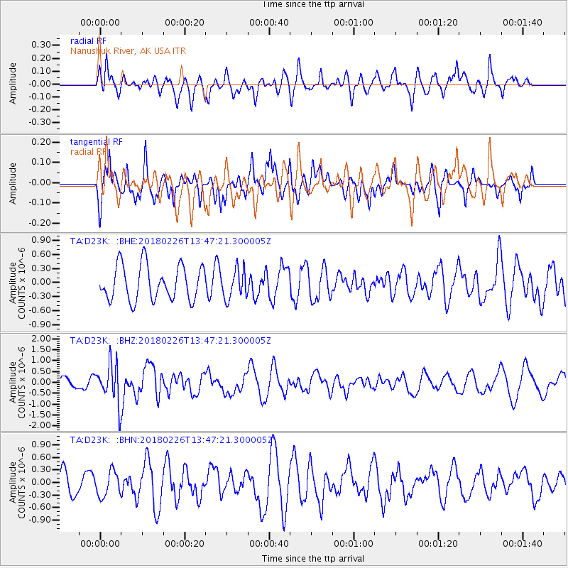
D23K Nanushuk River, AK USA - Earthquake Result Viewer
*The percent match for this event was below the threshold and hence no stack was calculated.
| Earthquake location: |
Ceram Sea |
| Earthquake latitude/longitude: |
-2.8/126.7 |
| Earthquake time(UTC): |
2018/02/26 (057) 13:34:53 GMT |
| Earthquake Depth: |
6.3 km |
| Earthquake Magnitude: |
6.0 Mww |
| Earthquake Catalog/Contributor: |
NEIC PDE/us |
|
| Network: |
TA USArray Transportable Network (new EarthScope stations) |
| Station: |
D23K Nanushuk River, AK USA |
| Lat/Lon: |
68.97 N/150.68 W |
| Elevation: |
406 m |
|
| Distance: |
89.9 deg |
| Az: |
20.98 deg |
| Baz: |
262.12 deg |
| Ray Param: |
$rayparam |
*The percent match for this event was below the threshold and hence was not used in the summary stack. |
|
| Radial Match: |
65.715 % |
| Radial Bump: |
400 |
| Transverse Match: |
61.304173 % |
| Transverse Bump: |
400 |
| SOD ConfigId: |
13570011 |
| Insert Time: |
2019-04-29 21:02:46.293 +0000 |
| GWidth: |
2.5 |
| Max Bumps: |
400 |
| Tol: |
0.001 |
|
Signal To Noise
| Channel | StoN | STA | LTA |
| TA:D23K: :BHZ:20180226T13:47:21.300005Z | 3.2295954 | 9.2050755E-7 | 2.8502257E-7 |
| TA:D23K: :BHN:20180226T13:47:21.300005Z | 1.0757259 | 3.0834397E-7 | 2.8663806E-7 |
| TA:D23K: :BHE:20180226T13:47:21.300005Z | 0.8637689 | 3.2177923E-7 | 3.725293E-7 |
| Arrivals |
| Ps | |
| PpPs | |
| PsPs/PpSs | |


