You are here: Home > Network List > TA - USArray Transportable Network (new EarthScope stations) Stations List
> Station D25K Kavik River, AK, USA > Earthquake Result Viewer
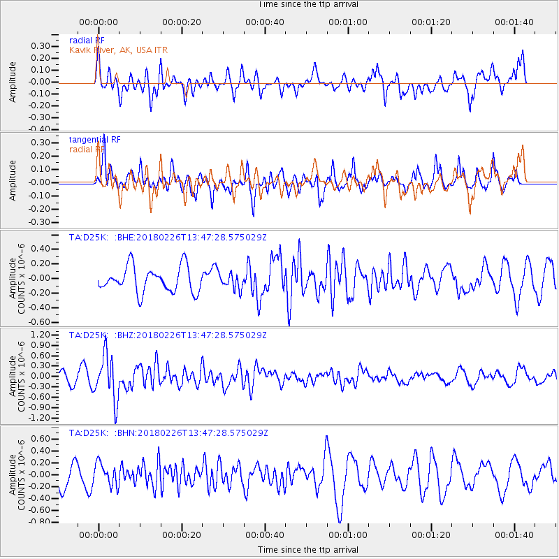
D25K Kavik River, AK, USA - Earthquake Result Viewer
*The percent match for this event was below the threshold and hence no stack was calculated.
| Earthquake location: |
Ceram Sea |
| Earthquake latitude/longitude: |
-2.8/126.7 |
| Earthquake time(UTC): |
2018/02/26 (057) 13:34:53 GMT |
| Earthquake Depth: |
6.3 km |
| Earthquake Magnitude: |
6.0 Mww |
| Earthquake Catalog/Contributor: |
NEIC PDE/us |
|
| Network: |
TA USArray Transportable Network (new EarthScope stations) |
| Station: |
D25K Kavik River, AK, USA |
| Lat/Lon: |
69.32 N/146.38 W |
| Elevation: |
770 m |
|
| Distance: |
91.5 deg |
| Az: |
20.781 deg |
| Baz: |
266.142 deg |
| Ray Param: |
$rayparam |
*The percent match for this event was below the threshold and hence was not used in the summary stack. |
|
| Radial Match: |
64.399994 % |
| Radial Bump: |
400 |
| Transverse Match: |
66.02829 % |
| Transverse Bump: |
400 |
| SOD ConfigId: |
13570011 |
| Insert Time: |
2019-04-29 21:02:48.150 +0000 |
| GWidth: |
2.5 |
| Max Bumps: |
400 |
| Tol: |
0.001 |
|
Signal To Noise
| Channel | StoN | STA | LTA |
| TA:D25K: :BHZ:20180226T13:47:28.575029Z | 3.770481 | 6.565339E-7 | 1.7412472E-7 |
| TA:D25K: :BHN:20180226T13:47:28.575029Z | 0.9184721 | 1.8952004E-7 | 2.0634273E-7 |
| TA:D25K: :BHE:20180226T13:47:28.575029Z | 0.570744 | 9.91347E-8 | 1.7369383E-7 |
| Arrivals |
| Ps | |
| PpPs | |
| PsPs/PpSs | |


