You are here: Home > Network List > TA - USArray Transportable Network (new EarthScope stations) Stations List
> Station K15K Wolf Creek Mountain, AK, USA > Earthquake Result Viewer
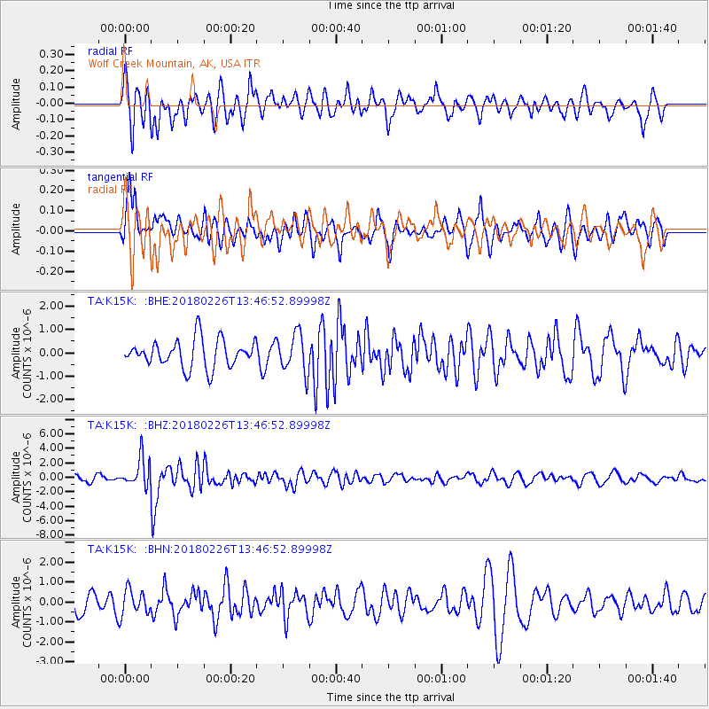
K15K Wolf Creek Mountain, AK, USA - Earthquake Result Viewer
*The percent match for this event was below the threshold and hence no stack was calculated.
| Earthquake location: |
Ceram Sea |
| Earthquake latitude/longitude: |
-2.8/126.7 |
| Earthquake time(UTC): |
2018/02/26 (057) 13:34:53 GMT |
| Earthquake Depth: |
6.3 km |
| Earthquake Magnitude: |
6.0 Mww |
| Earthquake Catalog/Contributor: |
NEIC PDE/us |
|
| Network: |
TA USArray Transportable Network (new EarthScope stations) |
| Station: |
K15K Wolf Creek Mountain, AK, USA |
| Lat/Lon: |
62.29 N/161.53 W |
| Elevation: |
346 m |
|
| Distance: |
84.0 deg |
| Az: |
26.507 deg |
| Baz: |
252.518 deg |
| Ray Param: |
$rayparam |
*The percent match for this event was below the threshold and hence was not used in the summary stack. |
|
| Radial Match: |
66.42652 % |
| Radial Bump: |
400 |
| Transverse Match: |
41.37418 % |
| Transverse Bump: |
382 |
| SOD ConfigId: |
13570011 |
| Insert Time: |
2019-04-29 21:03:32.425 +0000 |
| GWidth: |
2.5 |
| Max Bumps: |
400 |
| Tol: |
0.001 |
|
Signal To Noise
| Channel | StoN | STA | LTA |
| TA:K15K: :BHZ:20180226T13:46:52.89998Z | 3.843498 | 2.0037094E-6 | 5.2132447E-7 |
| TA:K15K: :BHN:20180226T13:46:52.89998Z | 0.7023401 | 6.1972713E-7 | 8.8237465E-7 |
| TA:K15K: :BHE:20180226T13:46:52.89998Z | 1.4051955 | 8.3950175E-7 | 5.9742706E-7 |
| Arrivals |
| Ps | |
| PpPs | |
| PsPs/PpSs | |


