You are here: Home > Network List > TA - USArray Transportable Network (new EarthScope stations) Stations List
> Station O17K Koliganek, Bristol Bay, AK, USA > Earthquake Result Viewer
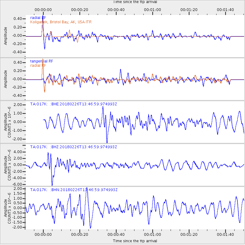
O17K Koliganek, Bristol Bay, AK, USA - Earthquake Result Viewer
*The percent match for this event was below the threshold and hence no stack was calculated.
| Earthquake location: |
Ceram Sea |
| Earthquake latitude/longitude: |
-2.8/126.7 |
| Earthquake time(UTC): |
2018/02/26 (057) 13:34:53 GMT |
| Earthquake Depth: |
6.3 km |
| Earthquake Magnitude: |
6.0 Mww |
| Earthquake Catalog/Contributor: |
NEIC PDE/us |
|
| Network: |
TA USArray Transportable Network (new EarthScope stations) |
| Station: |
O17K Koliganek, Bristol Bay, AK, USA |
| Lat/Lon: |
59.77 N/157.09 W |
| Elevation: |
156 m |
|
| Distance: |
85.5 deg |
| Az: |
29.531 deg |
| Baz: |
256.671 deg |
| Ray Param: |
$rayparam |
*The percent match for this event was below the threshold and hence was not used in the summary stack. |
|
| Radial Match: |
68.45851 % |
| Radial Bump: |
400 |
| Transverse Match: |
46.483627 % |
| Transverse Bump: |
400 |
| SOD ConfigId: |
13570011 |
| Insert Time: |
2019-04-29 21:03:56.361 +0000 |
| GWidth: |
2.5 |
| Max Bumps: |
400 |
| Tol: |
0.001 |
|
Signal To Noise
| Channel | StoN | STA | LTA |
| TA:O17K: :BHZ:20180226T13:46:59.974993Z | 3.3827648 | 1.9988847E-6 | 5.9090263E-7 |
| TA:O17K: :BHN:20180226T13:46:59.974993Z | 0.622212 | 2.8987677E-7 | 4.6588104E-7 |
| TA:O17K: :BHE:20180226T13:46:59.974993Z | 1.524101 | 8.0837583E-7 | 5.303952E-7 |
| Arrivals |
| Ps | |
| PpPs | |
| PsPs/PpSs | |


