You are here: Home > Network List > CN - Canadian National Seismograph Network Stations List
> Station INK INUVIK, NT > Earthquake Result Viewer
INK INUVIK, NT - Earthquake Result Viewer
*The percent match for this event was below the threshold and hence no stack was calculated.
| Earthquake location: |
New Guinea, Papua New Guinea |
| Earthquake latitude/longitude: |
-6.5/143.3 |
| Earthquake time(UTC): |
2018/02/26 (057) 15:17:57 GMT |
| Earthquake Depth: |
5.2 km |
| Earthquake Magnitude: |
6.3 Mww |
| Earthquake Catalog/Contributor: |
NEIC PDE/us |
|
| Network: |
CN Canadian National Seismograph Network |
| Station: |
INK INUVIK, NT |
| Lat/Lon: |
68.31 N/133.53 W |
| Elevation: |
44 m |
|
| Distance: |
93.5 deg |
| Az: |
21.707 deg |
| Baz: |
261.309 deg |
| Ray Param: |
$rayparam |
*The percent match for this event was below the threshold and hence was not used in the summary stack. |
|
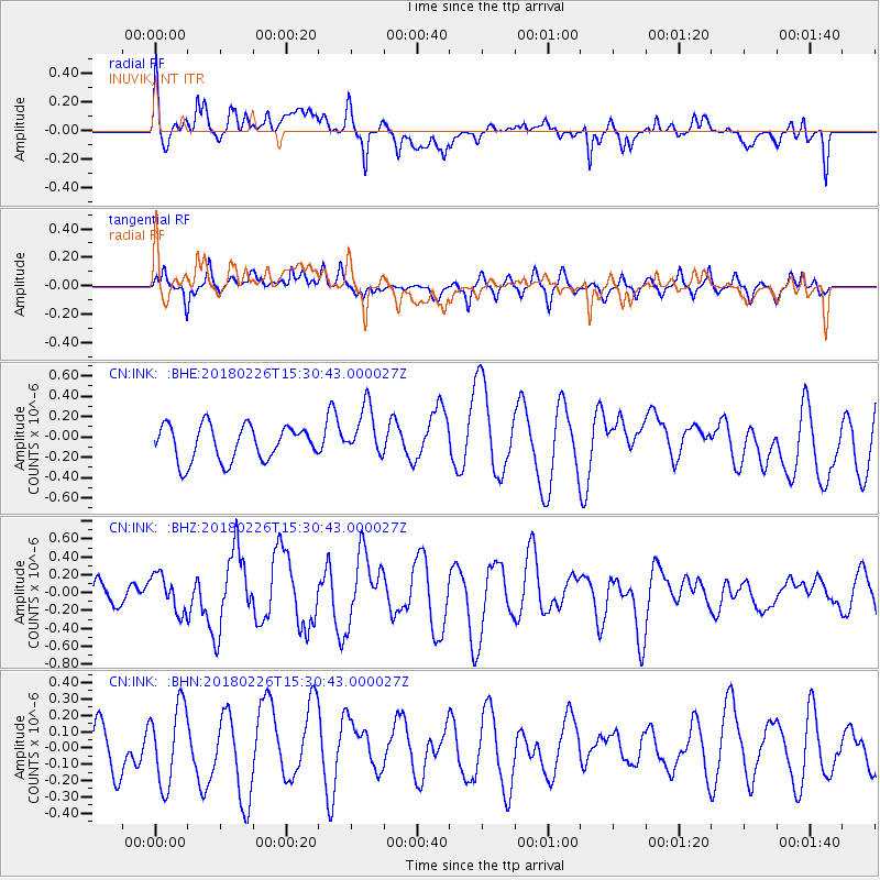
| Radial Match: |
46.516487 % |
| Radial Bump: |
400 |
| Transverse Match: |
73.564835 % |
| Transverse Bump: |
395 |
| SOD ConfigId: |
13570011 |
| Insert Time: |
2019-04-29 21:05:44.492 +0000 |
| GWidth: |
2.5 |
| Max Bumps: |
400 |
| Tol: |
0.001 |
|
Signal To Noise
| Channel | StoN | STA | LTA |
| CN:INK: :BHZ:20180226T15:30:43.000027Z | 1.4608979 | 2.0788057E-7 | 1.4229643E-7 |
| CN:INK: :BHN:20180226T15:30:43.000027Z | 1.5642266 | 2.4286794E-7 | 1.552639E-7 |
| CN:INK: :BHE:20180226T15:30:43.000027Z | 1.4427662 | 2.4807744E-7 | 1.7194571E-7 |
| Arrivals |
| Ps | |
| PpPs | |
| PsPs/PpSs | |


