You are here: Home > Network List > GS - US Geological Survey Networks Stations List
> Station KAN13 Rinehart Farm > Earthquake Result Viewer
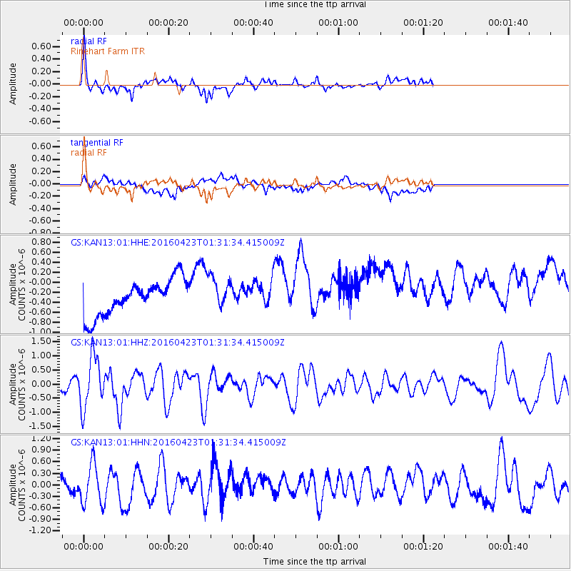
KAN13 Rinehart Farm - Earthquake Result Viewer
*The percent match for this event was below the threshold and hence no stack was calculated.
| Earthquake location: |
Near Coast Of Ecuador |
| Earthquake latitude/longitude: |
0.6/-80.3 |
| Earthquake time(UTC): |
2016/04/23 (114) 01:24:34 GMT |
| Earthquake Depth: |
10 km |
| Earthquake Magnitude: |
5.8 MWP |
| Earthquake Catalog/Contributor: |
NEIC PDE/NEIC COMCAT |
|
| Network: |
GS US Geological Survey Networks |
| Station: |
KAN13 Rinehart Farm |
| Lat/Lon: |
37.01 N/97.48 W |
| Elevation: |
340 m |
|
| Distance: |
39.6 deg |
| Az: |
338.179 deg |
| Baz: |
152.331 deg |
| Ray Param: |
$rayparam |
*The percent match for this event was below the threshold and hence was not used in the summary stack. |
|
| Radial Match: |
65.843735 % |
| Radial Bump: |
400 |
| Transverse Match: |
33.60338 % |
| Transverse Bump: |
400 |
| SOD ConfigId: |
1475611 |
| Insert Time: |
2016-05-07 01:26:30.973 +0000 |
| GWidth: |
2.5 |
| Max Bumps: |
400 |
| Tol: |
0.001 |
|
Signal To Noise
| Channel | StoN | STA | LTA |
| GS:KAN13:01:HHZ:20160423T01:31:34.415009Z | 5.6595545 | 9.2382913E-7 | 1.6323355E-7 |
| GS:KAN13:01:HHN:20160423T01:31:34.415009Z | 3.618133 | 5.405779E-7 | 1.4940797E-7 |
| GS:KAN13:01:HHE:20160423T01:31:34.415009Z | 0.9228756 | 3.2313142E-7 | 3.501354E-7 |
| Arrivals |
| Ps | |
| PpPs | |
| PsPs/PpSs | |


