You are here: Home > Network List > TA - USArray Transportable Network (new EarthScope stations) Stations List
> Station 109C Camp Elliot, Mirimar, CA, USA > Earthquake Result Viewer
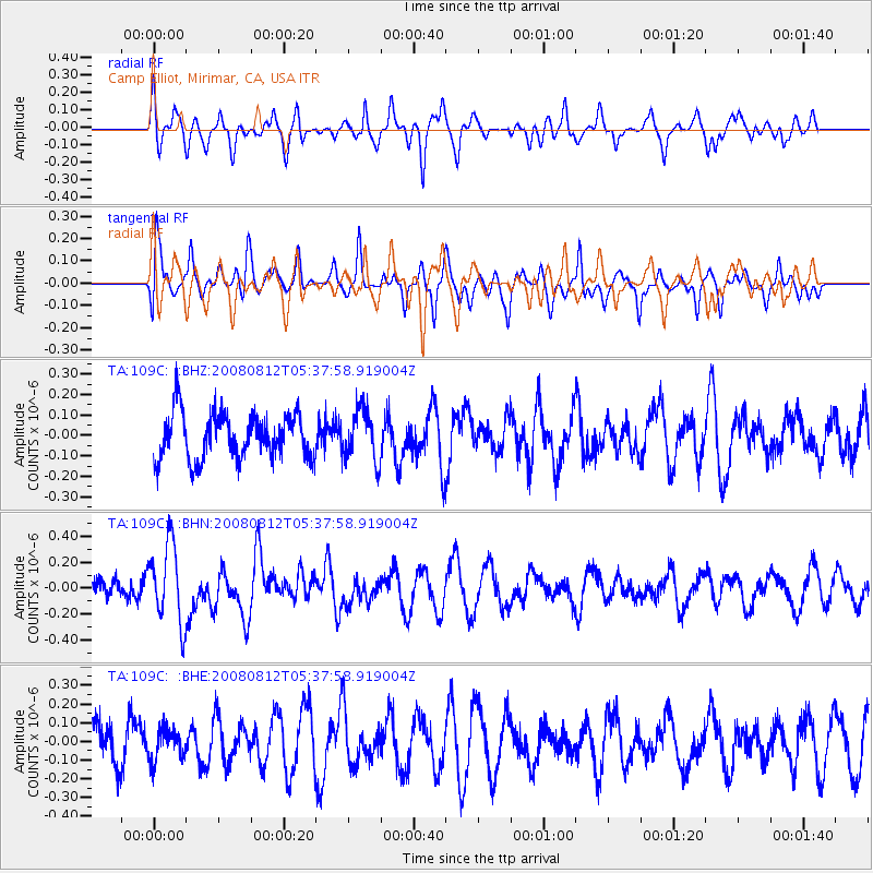
109C Camp Elliot, Mirimar, CA, USA - Earthquake Result Viewer
*The percent match for this event was below the threshold and hence no stack was calculated.
| Earthquake location: |
Santa Cruz Islands |
| Earthquake latitude/longitude: |
-11.4/166.2 |
| Earthquake time(UTC): |
2008/08/12 (225) 05:25:57 GMT |
| Earthquake Depth: |
38 km |
| Earthquake Magnitude: |
5.9 MW, 5.4 MS, 5.2 MB, 5.8 MW |
| Earthquake Catalog/Contributor: |
WHDF/NEIC |
|
| Network: |
TA USArray Transportable Network (new EarthScope stations) |
| Station: |
109C Camp Elliot, Mirimar, CA, USA |
| Lat/Lon: |
32.89 N/117.11 W |
| Elevation: |
150 m |
|
| Distance: |
85.2 deg |
| Az: |
55.244 deg |
| Baz: |
253.207 deg |
| Ray Param: |
$rayparam |
*The percent match for this event was below the threshold and hence was not used in the summary stack. |
|
| Radial Match: |
67.7901 % |
| Radial Bump: |
400 |
| Transverse Match: |
64.50428 % |
| Transverse Bump: |
395 |
| SOD ConfigId: |
2504 |
| Insert Time: |
2010-03-06 09:24:50.377 +0000 |
| GWidth: |
2.5 |
| Max Bumps: |
400 |
| Tol: |
0.001 |
|
Signal To Noise
| Channel | StoN | STA | LTA |
| TA:109C: :BHN:20080812T05:37:58.919004Z | 2.7113497 | 3.063612E-7 | 1.1299213E-7 |
| TA:109C: :BHE:20080812T05:37:58.919004Z | 0.8234238 | 8.124297E-8 | 9.8664835E-8 |
| TA:109C: :BHZ:20080812T05:37:58.919004Z | 1.1179646 | 1.2536422E-7 | 1.12136135E-7 |
| Arrivals |
| Ps | |
| PpPs | |
| PsPs/PpSs | |


