You are here: Home > Network List > TA - USArray Transportable Network (new EarthScope stations) Stations List
> Station H16K Elim, AK, USA > Earthquake Result Viewer
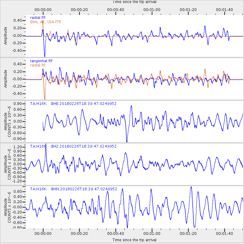
H16K Elim, AK, USA - Earthquake Result Viewer
*The percent match for this event was below the threshold and hence no stack was calculated.
| Earthquake location: |
New Guinea, Papua New Guinea |
| Earthquake latitude/longitude: |
-6.0/142.7 |
| Earthquake time(UTC): |
2018/02/26 (057) 18:28:03 GMT |
| Earthquake Depth: |
20 km |
| Earthquake Magnitude: |
5.4 Mww |
| Earthquake Catalog/Contributor: |
NEIC PDE/us |
|
| Network: |
TA USArray Transportable Network (new EarthScope stations) |
| Station: |
H16K Elim, AK, USA |
| Lat/Lon: |
64.64 N/162.24 W |
| Elevation: |
216 m |
|
| Distance: |
81.3 deg |
| Az: |
20.926 deg |
| Baz: |
235.56 deg |
| Ray Param: |
$rayparam |
*The percent match for this event was below the threshold and hence was not used in the summary stack. |
|
| Radial Match: |
65.2812 % |
| Radial Bump: |
400 |
| Transverse Match: |
60.311142 % |
| Transverse Bump: |
400 |
| SOD ConfigId: |
13570011 |
| Insert Time: |
2019-04-29 21:10:30.265 +0000 |
| GWidth: |
2.5 |
| Max Bumps: |
400 |
| Tol: |
0.001 |
|
Signal To Noise
| Channel | StoN | STA | LTA |
| TA:H16K: :BHZ:20180226T18:39:47.024995Z | 2.4915764 | 4.7469896E-7 | 1.9052153E-7 |
| TA:H16K: :BHN:20180226T18:39:47.024995Z | 0.80880415 | 1.5340855E-7 | 1.896733E-7 |
| TA:H16K: :BHE:20180226T18:39:47.024995Z | 0.6168365 | 1.7308079E-7 | 2.805943E-7 |
| Arrivals |
| Ps | |
| PpPs | |
| PsPs/PpSs | |


