217A Green Valley, AZ, USA - Earthquake Result Viewer
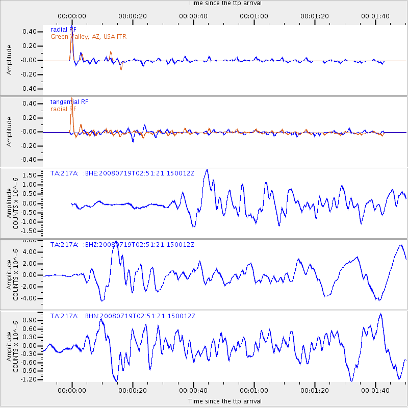
Earthquake location: Off East Coast Of Honshu, Japan
Earthquake latitude/longitude: 37.6/142.2
Earthquake time(UTC): 2008/07/19 (201) 02:39:28 GMT
Earthquake Depth: 22 km
Earthquake Magnitude: 6.2 MB, 7.0 MS, 7.0 MW, 6.9 MW
Earthquake Catalog/Contributor: WHDF/NEIC
Network: TA USArray Transportable Network (new EarthScope stations)
Station: 217A Green Valley, AZ, USA
Lat/Lon: 31.77 N/110.82 W
Elevation: 1412 m
Distance: 83.1 deg
Az: 55.144 deg
Baz: 310.027 deg
Ray Param: 0.046418995
Estimated Moho Depth: 27.25 km
Estimated Crust Vp/Vs: 1.65
Assumed Crust Vp: 6.264 km/s
Estimated Crust Vs: 3.796 km/s
Estimated Crust Poisson's Ratio: 0.21
Radial Match: 96.08096 %
Radial Bump: 328
Transverse Match: 80.18801 %
Transverse Bump: 400
SOD ConfigId: 2504
Insert Time: 2010-03-06 09:25:08.020 +0000
GWidth: 2.5
Max Bumps: 400
Tol: 0.001

Signal To Noise

ChannelStoNSTALTA
TA:217A: :BHZ:20080719T02:51:21.150012Z2.96144343.4722055E-71.1724706E-7
TA:217A: :BHN:20080719T02:51:21.150012Z0.83506241.3586649E-71.627022E-7
TA:217A: :BHE:20080719T02:51:21.150012Z1.19198481.1891959E-79.976603E-8
Arrivals
Ps2.9 SECOND
PpPs11 SECOND
PsPs/PpSs14 SECOND