
217A Green Valley, AZ, USA - Earthquake Result Viewer
| ||||||||||||||||||
| ||||||||||||||||||
| ||||||||||||||||||
|
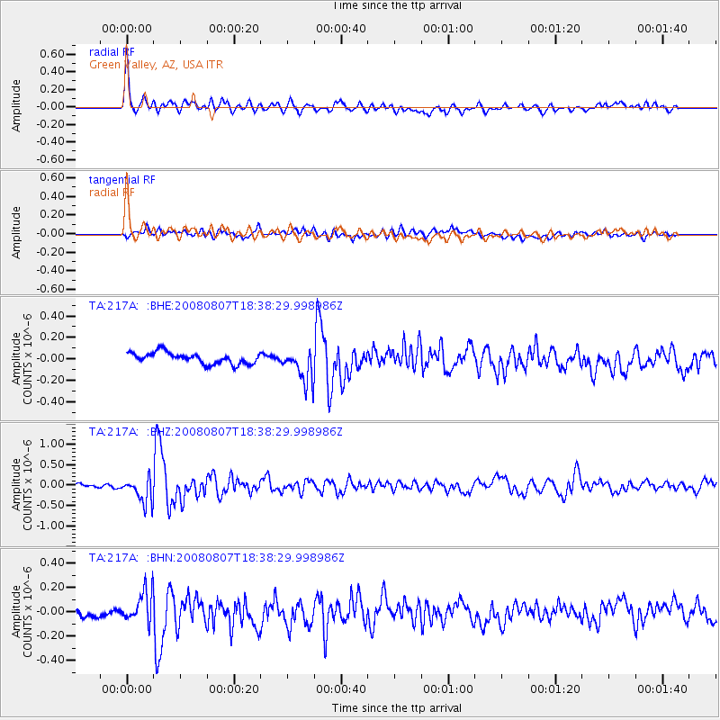
Signal To Noise
| Channel | StoN | STA | LTA |
| TA:217A: :BHZ:20080807T18:38:29.998986Z | 8.310414 | 3.1097042E-7 | 3.7419362E-8 |
| TA:217A: :BHN:20080807T18:38:29.998986Z | 3.7621615 | 1.2906585E-7 | 3.4306304E-8 |
| TA:217A: :BHE:20080807T18:38:29.998986Z | 3.048023 | 1.6029122E-7 | 5.2588586E-8 |
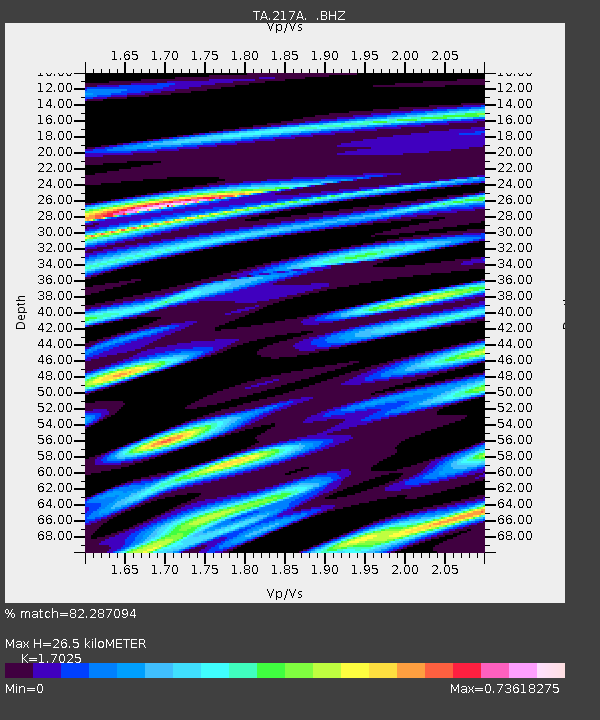
| Arrivals | |
| Ps | 3.1 SECOND |
| PpPs | 11 SECOND |
| PsPs/PpSs | 14 SECOND |

