You are here: Home > Network List > TA - USArray Transportable Network (new EarthScope stations) Stations List
> Station F20K Avaraart Lake, AK, USA > Earthquake Result Viewer
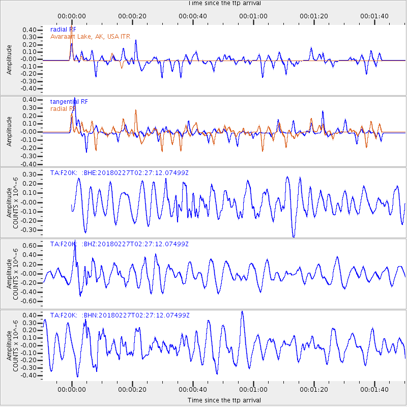
F20K Avaraart Lake, AK, USA - Earthquake Result Viewer
*The percent match for this event was below the threshold and hence no stack was calculated.
| Earthquake location: |
New Guinea, Papua New Guinea |
| Earthquake latitude/longitude: |
-6.6/143.2 |
| Earthquake time(UTC): |
2018/02/27 (058) 02:15:07 GMT |
| Earthquake Depth: |
10 km |
| Earthquake Magnitude: |
4.9 Mww |
| Earthquake Catalog/Contributor: |
NEIC PDE/us |
|
| Network: |
TA USArray Transportable Network (new EarthScope stations) |
| Station: |
F20K Avaraart Lake, AK, USA |
| Lat/Lon: |
67.05 N/155.73 W |
| Elevation: |
136 m |
|
| Distance: |
85.2 deg |
| Az: |
20.142 deg |
| Baz: |
240.734 deg |
| Ray Param: |
$rayparam |
*The percent match for this event was below the threshold and hence was not used in the summary stack. |
|
| Radial Match: |
56.576015 % |
| Radial Bump: |
400 |
| Transverse Match: |
41.57075 % |
| Transverse Bump: |
235 |
| SOD ConfigId: |
13570011 |
| Insert Time: |
2019-04-29 21:13:56.347 +0000 |
| GWidth: |
2.5 |
| Max Bumps: |
400 |
| Tol: |
0.001 |
|
Signal To Noise
| Channel | StoN | STA | LTA |
| TA:F20K: :BHZ:20180227T02:27:12.07499Z | 2.713964 | 2.986352E-7 | 1.1003654E-7 |
| TA:F20K: :BHN:20180227T02:27:12.07499Z | 1.4328521 | 2.2933244E-7 | 1.6005312E-7 |
| TA:F20K: :BHE:20180227T02:27:12.07499Z | 0.82389045 | 1.1913275E-7 | 1.445978E-7 |
| Arrivals |
| Ps | |
| PpPs | |
| PsPs/PpSs | |


