You are here: Home > Network List > TA - USArray Transportable Network (new EarthScope stations) Stations List
> Station H16K Elim, AK, USA > Earthquake Result Viewer
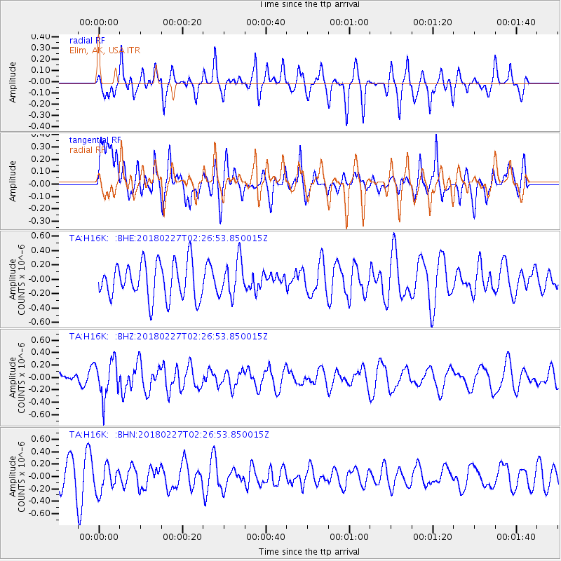
H16K Elim, AK, USA - Earthquake Result Viewer
*The percent match for this event was below the threshold and hence no stack was calculated.
| Earthquake location: |
New Guinea, Papua New Guinea |
| Earthquake latitude/longitude: |
-6.6/143.2 |
| Earthquake time(UTC): |
2018/02/27 (058) 02:15:07 GMT |
| Earthquake Depth: |
10 km |
| Earthquake Magnitude: |
4.9 Mww |
| Earthquake Catalog/Contributor: |
NEIC PDE/us |
|
| Network: |
TA USArray Transportable Network (new EarthScope stations) |
| Station: |
H16K Elim, AK, USA |
| Lat/Lon: |
64.64 N/162.24 W |
| Elevation: |
216 m |
|
| Distance: |
81.6 deg |
| Az: |
20.764 deg |
| Baz: |
234.866 deg |
| Ray Param: |
$rayparam |
*The percent match for this event was below the threshold and hence was not used in the summary stack. |
|
| Radial Match: |
56.91325 % |
| Radial Bump: |
400 |
| Transverse Match: |
43.272755 % |
| Transverse Bump: |
400 |
| SOD ConfigId: |
13570011 |
| Insert Time: |
2019-04-29 21:14:00.735 +0000 |
| GWidth: |
2.5 |
| Max Bumps: |
400 |
| Tol: |
0.001 |
|
Signal To Noise
| Channel | StoN | STA | LTA |
| TA:H16K: :BHZ:20180227T02:26:53.850015Z | 2.0260286 | 3.001736E-7 | 1.4815862E-7 |
| TA:H16K: :BHN:20180227T02:26:53.850015Z | 0.9808336 | 2.1875123E-7 | 2.2302584E-7 |
| TA:H16K: :BHE:20180227T02:26:53.850015Z | 1.0044782 | 2.5121523E-7 | 2.5009524E-7 |
| Arrivals |
| Ps | |
| PpPs | |
| PsPs/PpSs | |


