You are here: Home > Network List > CI - Caltech Regional Seismic Network Stations List
> Station MPM Manuel Prospect Mine, California, USA > Earthquake Result Viewer
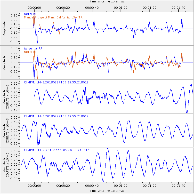
MPM Manuel Prospect Mine, California, USA - Earthquake Result Viewer
*The percent match for this event was below the threshold and hence no stack was calculated.
| Earthquake location: |
Vanuatu Islands |
| Earthquake latitude/longitude: |
-18.9/169.3 |
| Earthquake time(UTC): |
2018/02/27 (058) 05:17:58 GMT |
| Earthquake Depth: |
196 km |
| Earthquake Magnitude: |
5.5 Mww |
| Earthquake Catalog/Contributor: |
NEIC PDE/us |
|
| Network: |
CI Caltech Regional Seismic Network |
| Station: |
MPM Manuel Prospect Mine, California, USA |
| Lat/Lon: |
36.06 N/117.49 W |
| Elevation: |
185 m |
|
| Distance: |
88.1 deg |
| Az: |
50.915 deg |
| Baz: |
245.119 deg |
| Ray Param: |
$rayparam |
*The percent match for this event was below the threshold and hence was not used in the summary stack. |
|
| Radial Match: |
70.80764 % |
| Radial Bump: |
400 |
| Transverse Match: |
59.913437 % |
| Transverse Bump: |
400 |
| SOD ConfigId: |
13570011 |
| Insert Time: |
2019-04-29 21:16:32.236 +0000 |
| GWidth: |
2.5 |
| Max Bumps: |
400 |
| Tol: |
0.001 |
|
Signal To Noise
| Channel | StoN | STA | LTA |
| CI:MPM: :HHZ:20180227T05:29:55.21801Z | 2.7604825 | 6.0111023E-7 | 2.1775548E-7 |
| CI:MPM: :HHN:20180227T05:29:55.21801Z | 1.2192396 | 1.9285241E-7 | 1.5817433E-7 |
| CI:MPM: :HHE:20180227T05:29:55.21801Z | 1.2245951 | 2.178703E-7 | 1.7791211E-7 |
| Arrivals |
| Ps | |
| PpPs | |
| PsPs/PpSs | |


