217A Green Valley, AZ, USA - Earthquake Result Viewer
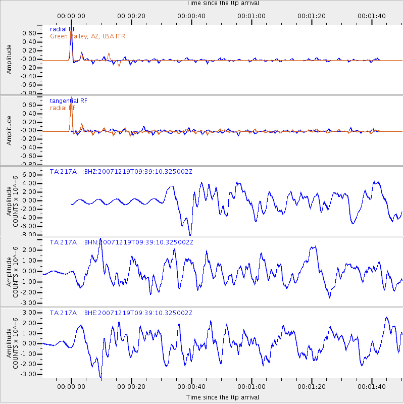
Earthquake location: Andreanof Islands, Aleutian Is.
Earthquake latitude/longitude: 51.4/-179.5
Earthquake time(UTC): 2007/12/19 (353) 09:30:27 GMT
Earthquake Depth: 29 km
Earthquake Magnitude: 6.4 MB, 7.1 MS, 7.1 MW, 7.0 MW
Earthquake Catalog/Contributor: WHDF/NEIC
Network: TA USArray Transportable Network (new EarthScope stations)
Station: 217A Green Valley, AZ, USA
Lat/Lon: 31.77 N/110.82 W
Elevation: 1412 m
Distance: 53.0 deg
Az: 83.703 deg
Baz: 312.974 deg
Ray Param: 0.06635797
Estimated Moho Depth: 25.0 km
Estimated Crust Vp/Vs: 1.84
Assumed Crust Vp: 6.264 km/s
Estimated Crust Vs: 3.4 km/s
Estimated Crust Poisson's Ratio: 0.29
Radial Match: 94.60731 %
Radial Bump: 246
Transverse Match: 73.30661 %
Transverse Bump: 400
SOD ConfigId: 2564
Insert Time: 2010-03-06 09:25:49.427 +0000
GWidth: 2.5
Max Bumps: 400
Tol: 0.001

Signal To Noise

ChannelStoNSTALTA
TA:217A: :BHN:20071219T09:39:10.325002Z4.70372448.0289794E-71.706941E-7
TA:217A: :BHE:20071219T09:39:10.325002Z10.1845361.1241474E-61.1037787E-7
TA:217A: :BHZ:20071219T09:39:10.325002Z5.0861982.260466E-64.444314E-7
Arrivals
Ps3.5 SECOND
PpPs11 SECOND
PsPs/PpSs14 SECOND