You are here: Home > Network List > TA - USArray Transportable Network (new EarthScope stations) Stations List
> Station L15K Ungalak Mountain, AK, USA > Earthquake Result Viewer
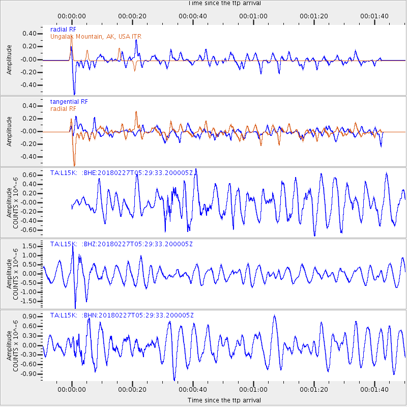
L15K Ungalak Mountain, AK, USA - Earthquake Result Viewer
*The percent match for this event was below the threshold and hence no stack was calculated.
| Earthquake location: |
Vanuatu Islands |
| Earthquake latitude/longitude: |
-18.9/169.3 |
| Earthquake time(UTC): |
2018/02/27 (058) 05:17:58 GMT |
| Earthquake Depth: |
196 km |
| Earthquake Magnitude: |
5.5 Mww |
| Earthquake Catalog/Contributor: |
NEIC PDE/us |
|
| Network: |
TA USArray Transportable Network (new EarthScope stations) |
| Station: |
L15K Ungalak Mountain, AK, USA |
| Lat/Lon: |
61.68 N/161.49 W |
| Elevation: |
219 m |
|
| Distance: |
83.6 deg |
| Az: |
13.549 deg |
| Baz: |
207.724 deg |
| Ray Param: |
$rayparam |
*The percent match for this event was below the threshold and hence was not used in the summary stack. |
|
| Radial Match: |
63.456776 % |
| Radial Bump: |
400 |
| Transverse Match: |
49.02084 % |
| Transverse Bump: |
400 |
| SOD ConfigId: |
13570011 |
| Insert Time: |
2019-04-29 21:18:58.701 +0000 |
| GWidth: |
2.5 |
| Max Bumps: |
400 |
| Tol: |
0.001 |
|
Signal To Noise
| Channel | StoN | STA | LTA |
| TA:L15K: :BHZ:20180227T05:29:33.200005Z | 2.4047189 | 8.397586E-7 | 3.492128E-7 |
| TA:L15K: :BHN:20180227T05:29:33.200005Z | 0.90147597 | 2.7908519E-7 | 3.0958694E-7 |
| TA:L15K: :BHE:20180227T05:29:33.200005Z | 1.0547751 | 2.2306531E-7 | 2.114814E-7 |
| Arrivals |
| Ps | |
| PpPs | |
| PsPs/PpSs | |


