You are here: Home > Network List > IW - Intermountain West Stations List
> Station MOOW Moose Ponds, Wyoming, USA > Earthquake Result Viewer
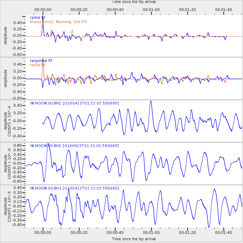
MOOW Moose Ponds, Wyoming, USA - Earthquake Result Viewer
*The percent match for this event was below the threshold and hence no stack was calculated.
| Earthquake location: |
Near Coast Of Ecuador |
| Earthquake latitude/longitude: |
0.6/-80.3 |
| Earthquake time(UTC): |
2016/04/23 (114) 01:24:34 GMT |
| Earthquake Depth: |
10 km |
| Earthquake Magnitude: |
5.8 MWP |
| Earthquake Catalog/Contributor: |
NEIC PDE/NEIC COMCAT |
|
| Network: |
IW Intermountain West |
| Station: |
MOOW Moose Ponds, Wyoming, USA |
| Lat/Lon: |
43.75 N/110.74 W |
| Elevation: |
2128 m |
|
| Distance: |
50.8 deg |
| Az: |
331.698 deg |
| Baz: |
139.141 deg |
| Ray Param: |
$rayparam |
*The percent match for this event was below the threshold and hence was not used in the summary stack. |
|
| Radial Match: |
72.501274 % |
| Radial Bump: |
400 |
| Transverse Match: |
57.330193 % |
| Transverse Bump: |
400 |
| SOD ConfigId: |
1475611 |
| Insert Time: |
2016-05-07 01:29:07.810 +0000 |
| GWidth: |
2.5 |
| Max Bumps: |
400 |
| Tol: |
0.001 |
|
Signal To Noise
| Channel | StoN | STA | LTA |
| IW:MOOW:00:BHZ:20160423T01:33:03.589996Z | 3.990009 | 5.717404E-7 | 1.4329301E-7 |
| IW:MOOW:00:BH1:20160423T01:33:03.589996Z | 2.8328578 | 1.9463587E-7 | 6.870655E-8 |
| IW:MOOW:00:BH2:20160423T01:33:03.589996Z | 1.6637839 | 2.0789028E-7 | 1.2495029E-7 |
| Arrivals |
| Ps | |
| PpPs | |
| PsPs/PpSs | |


