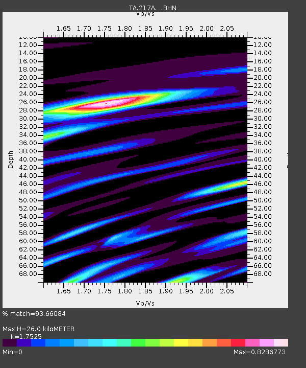
217A Green Valley, AZ, USA - Earthquake Result Viewer
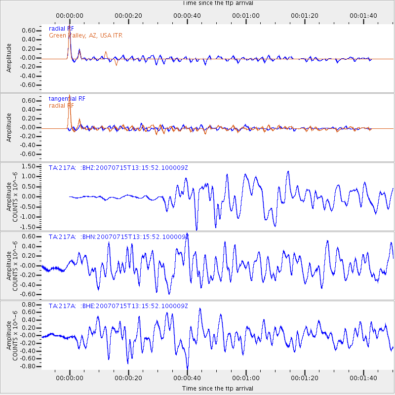
Earthquake location: Fox Islands, Aleutian Islands
Earthquake latitude/longitude: 52.5/-168.0
Earthquake time(UTC): 2007/07/15 (196) 13:08:00 GMT
Earthquake Depth: 10 km
Earthquake Magnitude: 5.8 MB, 5.9 MS, 6.1 MW, 6.0 MW
Earthquake Catalog/Contributor: WHDF/NEIC
Network: TA USArray Transportable Network (new EarthScope stations)
Station: 217A Green Valley, AZ, USA
Lat/Lon: 31.77 N/110.82 W
Elevation: 1412 m
Distance: 45.9 deg
Az: 93.532 deg
Baz: 314.213 deg
Ray Param: 0.071008414
Estimated Moho Depth: 26.0 km
Estimated Crust Vp/Vs: 1.75
Assumed Crust Vp: 6.264 km/s
Estimated Crust Vs: 3.574 km/s
Estimated Crust Poisson's Ratio: 0.26
Radial Match: 93.66084 %
Radial Bump: 334
Transverse Match: 81.553474 %
Transverse Bump: 400
SOD ConfigId: 2564
Insert Time: 2010-03-06 09:27:00.630 +0000
GWidth: 2.5
Max Bumps: 400
Tol: 0.001

Signal To Noise

ChannelStoNSTALTA
TA:217A: :BHN:20070715T13:15:52.100009Z2.76916961.350842E-74.8781487E-8
TA:217A: :BHE:20070715T13:15:52.100009Z4.13411.2804516E-73.0972924E-8
TA:217A: :BHZ:20070715T13:15:52.100009Z5.100372.6584314E-75.2122324E-8
Arrivals
Ps3.3 SECOND
PpPs11 SECOND
PsPs/PpSs14 SECOND