You are here: Home > Network List > TA - USArray Transportable Network (new EarthScope stations) Stations List
> Station I30M Mount Dempster, Yukon, CAN > Earthquake Result Viewer
I30M Mount Dempster, Yukon, CAN - Earthquake Result Viewer
*The percent match for this event was below the threshold and hence no stack was calculated.
| Earthquake location: |
New Guinea, Papua New Guinea |
| Earthquake latitude/longitude: |
-6.4/143.0 |
| Earthquake time(UTC): |
2018/02/27 (058) 06:19:12 GMT |
| Earthquake Depth: |
10 km |
| Earthquake Magnitude: |
5.6 Mww |
| Earthquake Catalog/Contributor: |
NEIC PDE/us |
|
| Network: |
TA USArray Transportable Network (new EarthScope stations) |
| Station: |
I30M Mount Dempster, Yukon, CAN |
| Lat/Lon: |
65.22 N/136.38 W |
| Elevation: |
1399 m |
|
| Distance: |
91.8 deg |
| Az: |
24.579 deg |
| Baz: |
258.786 deg |
| Ray Param: |
$rayparam |
*The percent match for this event was below the threshold and hence was not used in the summary stack. |
|
| Radial Match: |
47.98744 % |
| Radial Bump: |
400 |
| Transverse Match: |
72.09473 % |
| Transverse Bump: |
400 |
| SOD ConfigId: |
13570011 |
| Insert Time: |
2019-04-29 21:22:58.477 +0000 |
| GWidth: |
2.5 |
| Max Bumps: |
400 |
| Tol: |
0.001 |
|
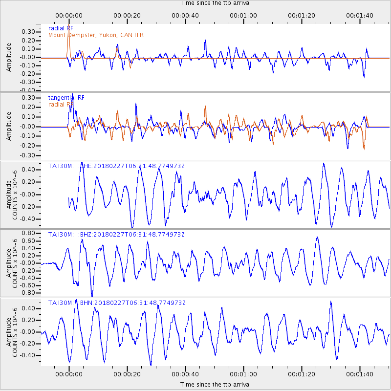
Signal To Noise
| Channel | StoN | STA | LTA |
| TA:I30M: :BHZ:20180227T06:31:48.774973Z | 3.4902818 | 4.3028356E-7 | 1.2328046E-7 |
| TA:I30M: :BHN:20180227T06:31:48.774973Z | 3.3224082 | 3.4383982E-7 | 1.0349113E-7 |
| TA:I30M: :BHE:20180227T06:31:48.774973Z | 1.3098605 | 3.140447E-7 | 2.397543E-7 |
| Arrivals |
| Ps | |
| PpPs | |
| PsPs/PpSs | |


