You are here: Home > Network List > TA - USArray Transportable Network (new EarthScope stations) Stations List
> Station J20K Nowitna River, AK, USA > Earthquake Result Viewer
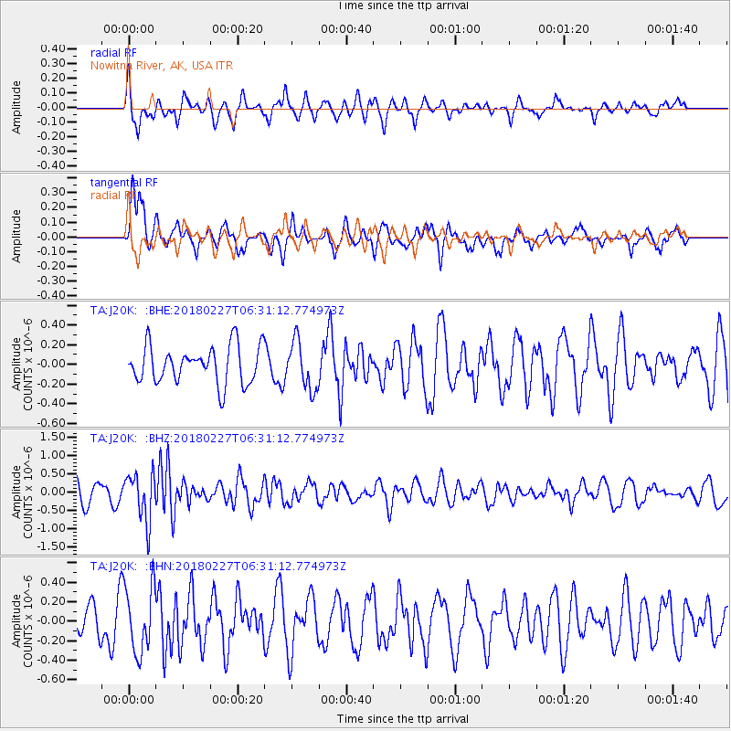
J20K Nowitna River, AK, USA - Earthquake Result Viewer
*The percent match for this event was below the threshold and hence no stack was calculated.
| Earthquake location: |
New Guinea, Papua New Guinea |
| Earthquake latitude/longitude: |
-6.4/143.0 |
| Earthquake time(UTC): |
2018/02/27 (058) 06:19:12 GMT |
| Earthquake Depth: |
10 km |
| Earthquake Magnitude: |
5.6 Mww |
| Earthquake Catalog/Contributor: |
NEIC PDE/us |
|
| Network: |
TA USArray Transportable Network (new EarthScope stations) |
| Station: |
J20K Nowitna River, AK, USA |
| Lat/Lon: |
64.18 N/154.15 W |
| Elevation: |
314 m |
|
| Distance: |
84.3 deg |
| Az: |
23.047 deg |
| Baz: |
242.664 deg |
| Ray Param: |
$rayparam |
*The percent match for this event was below the threshold and hence was not used in the summary stack. |
|
| Radial Match: |
50.60257 % |
| Radial Bump: |
340 |
| Transverse Match: |
50.041935 % |
| Transverse Bump: |
400 |
| SOD ConfigId: |
13570011 |
| Insert Time: |
2019-04-29 21:23:00.172 +0000 |
| GWidth: |
2.5 |
| Max Bumps: |
400 |
| Tol: |
0.001 |
|
Signal To Noise
| Channel | StoN | STA | LTA |
| TA:J20K: :BHZ:20180227T06:31:12.774973Z | 3.2861423 | 6.562437E-7 | 1.9970032E-7 |
| TA:J20K: :BHN:20180227T06:31:12.774973Z | 1.5006243 | 3.3815147E-7 | 2.2534053E-7 |
| TA:J20K: :BHE:20180227T06:31:12.774973Z | 1.2962371 | 2.4473337E-7 | 1.8880291E-7 |
| Arrivals |
| Ps | |
| PpPs | |
| PsPs/PpSs | |


