You are here: Home > Network List > TA - USArray Transportable Network (new EarthScope stations) Stations List
> Station L15K Ungalak Mountain, AK, USA > Earthquake Result Viewer
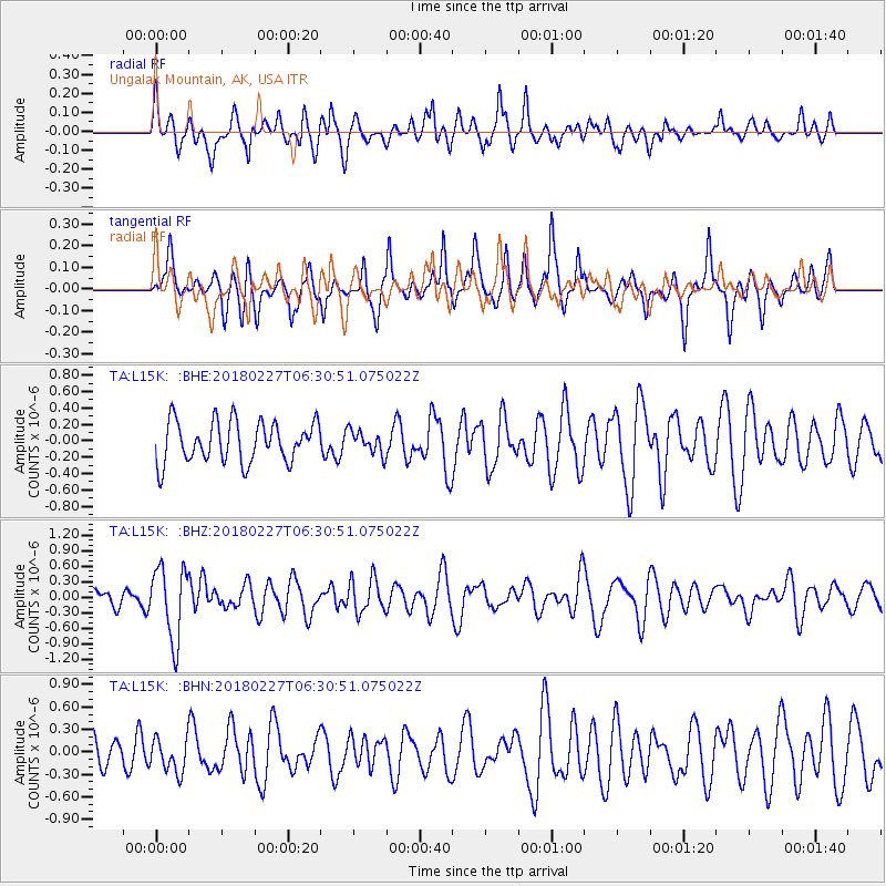
L15K Ungalak Mountain, AK, USA - Earthquake Result Viewer
*The percent match for this event was below the threshold and hence no stack was calculated.
| Earthquake location: |
New Guinea, Papua New Guinea |
| Earthquake latitude/longitude: |
-6.4/143.0 |
| Earthquake time(UTC): |
2018/02/27 (058) 06:19:12 GMT |
| Earthquake Depth: |
10 km |
| Earthquake Magnitude: |
5.6 Mww |
| Earthquake Catalog/Contributor: |
NEIC PDE/us |
|
| Network: |
TA USArray Transportable Network (new EarthScope stations) |
| Station: |
L15K Ungalak Mountain, AK, USA |
| Lat/Lon: |
61.68 N/161.49 W |
| Elevation: |
219 m |
|
| Distance: |
80.1 deg |
| Az: |
23.499 deg |
| Baz: |
236.195 deg |
| Ray Param: |
$rayparam |
*The percent match for this event was below the threshold and hence was not used in the summary stack. |
|
| Radial Match: |
45.620358 % |
| Radial Bump: |
400 |
| Transverse Match: |
63.440517 % |
| Transverse Bump: |
367 |
| SOD ConfigId: |
13570011 |
| Insert Time: |
2019-04-29 21:23:05.936 +0000 |
| GWidth: |
2.5 |
| Max Bumps: |
400 |
| Tol: |
0.001 |
|
Signal To Noise
| Channel | StoN | STA | LTA |
| TA:L15K: :BHZ:20180227T06:30:51.075022Z | 2.5446496 | 7.01405E-7 | 2.756391E-7 |
| TA:L15K: :BHN:20180227T06:30:51.075022Z | 0.8862392 | 2.2848204E-7 | 2.578108E-7 |
| TA:L15K: :BHE:20180227T06:30:51.075022Z | 0.56619436 | 1.4114771E-7 | 2.49292E-7 |
| Arrivals |
| Ps | |
| PpPs | |
| PsPs/PpSs | |


