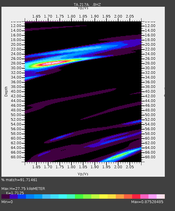
217A Green Valley, AZ, USA - Earthquake Result Viewer
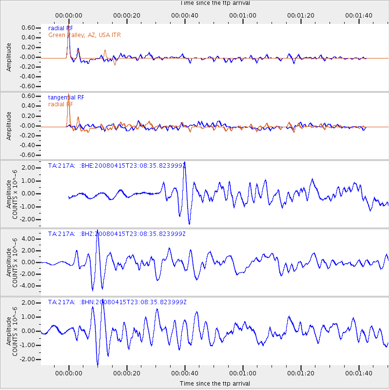
Earthquake location: Andreanof Islands, Aleutian Is.
Earthquake latitude/longitude: 51.9/-179.4
Earthquake time(UTC): 2008/04/15 (106) 22:59:51 GMT
Earthquake Depth: 10 km
Earthquake Magnitude: 6.1 MB, 6.4 MS, 6.4 MW, 6.4 MW
Earthquake Catalog/Contributor: WHDF/NEIC
Network: TA USArray Transportable Network (new EarthScope stations)
Station: 217A Green Valley, AZ, USA
Lat/Lon: 31.77 N/110.82 W
Elevation: 1412 m
Distance: 52.8 deg
Az: 84.193 deg
Baz: 313.574 deg
Ray Param: 0.066513546
Estimated Moho Depth: 27.75 km
Estimated Crust Vp/Vs: 1.71
Assumed Crust Vp: 6.264 km/s
Estimated Crust Vs: 3.658 km/s
Estimated Crust Poisson's Ratio: 0.24
Radial Match: 91.71461 %
Radial Bump: 400
Transverse Match: 69.2166 %
Transverse Bump: 400
SOD ConfigId: 2504
Insert Time: 2010-03-06 09:27:24.851 +0000
GWidth: 2.5
Max Bumps: 400
Tol: 0.001

Signal To Noise

ChannelStoNSTALTA
TA:217A: :BHZ:20080415T23:08:35.823999Z4.2471628.4995787E-72.0012372E-7
TA:217A: :BHN:20080415T23:08:35.823999Z1.30186833.0270255E-72.3251395E-7
TA:217A: :BHE:20080415T23:08:35.823999Z2.30682874.0325847E-71.7481075E-7
Arrivals
Ps3.3 SECOND
PpPs11 SECOND
PsPs/PpSs15 SECOND