You are here: Home > Network List > TA - USArray Transportable Network (new EarthScope stations) Stations List
> Station 217A Green Valley, AZ, USA > Earthquake Result Viewer
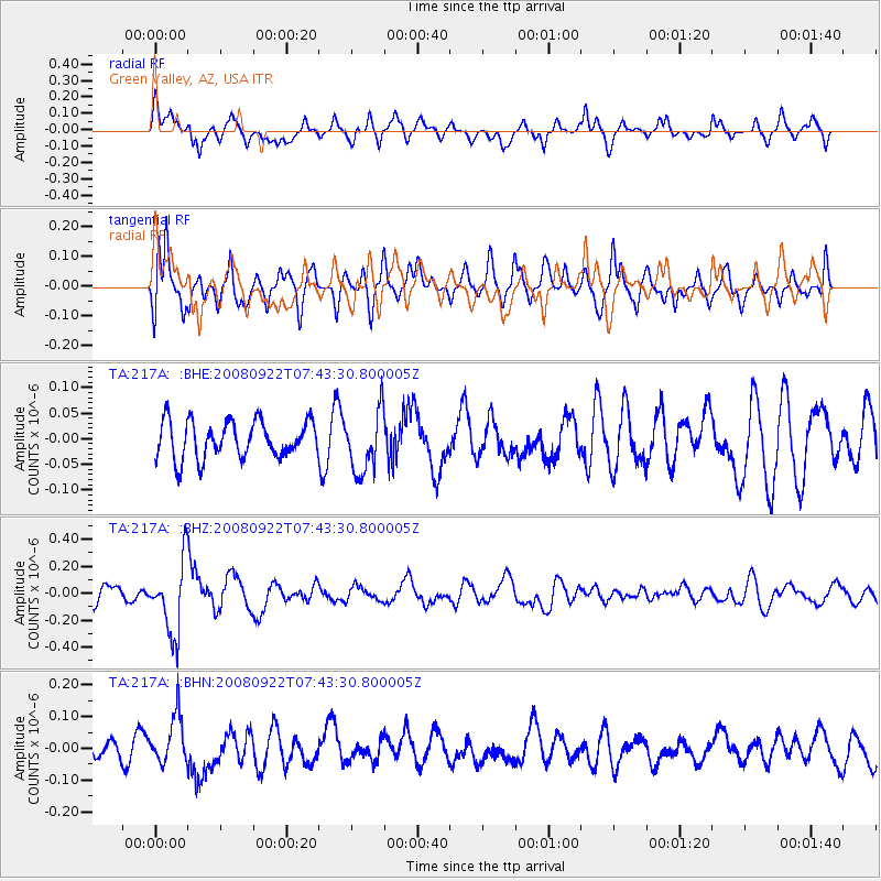
217A Green Valley, AZ, USA - Earthquake Result Viewer
*The percent match for this event was below the threshold and hence no stack was calculated.
| Earthquake location: |
Hokkaido, Japan Region |
| Earthquake latitude/longitude: |
41.6/140.4 |
| Earthquake time(UTC): |
2008/09/22 (266) 07:31:59 GMT |
| Earthquake Depth: |
149 km |
| Earthquake Magnitude: |
5.7 MW, 5.3 MB, 5.6 MW |
| Earthquake Catalog/Contributor: |
WHDF/NEIC |
|
| Network: |
TA USArray Transportable Network (new EarthScope stations) |
| Station: |
217A Green Valley, AZ, USA |
| Lat/Lon: |
31.77 N/110.82 W |
| Elevation: |
1412 m |
|
| Distance: |
81.9 deg |
| Az: |
54.562 deg |
| Baz: |
314.135 deg |
| Ray Param: |
$rayparam |
*The percent match for this event was below the threshold and hence was not used in the summary stack. |
|
| Radial Match: |
74.4834 % |
| Radial Bump: |
400 |
| Transverse Match: |
66.96562 % |
| Transverse Bump: |
400 |
| SOD ConfigId: |
2560 |
| Insert Time: |
2010-03-06 09:28:37.418 +0000 |
| GWidth: |
2.5 |
| Max Bumps: |
400 |
| Tol: |
0.001 |
|
Signal To Noise
| Channel | StoN | STA | LTA |
| TA:217A: :BHZ:20080922T07:43:30.800005Z | 4.1215835 | 2.688966E-7 | 6.524109E-8 |
| TA:217A: :BHN:20080922T07:43:30.800005Z | 2.2537796 | 7.779419E-8 | 3.4517214E-8 |
| TA:217A: :BHE:20080922T07:43:30.800005Z | 1.6476064 | 5.9239422E-8 | 3.5954837E-8 |
| Arrivals |
| Ps | |
| PpPs | |
| PsPs/PpSs | |


