You are here: Home > Network List > TA - USArray Transportable Network (new EarthScope stations) Stations List
> Station F21K Alatna River, AK, USA > Earthquake Result Viewer
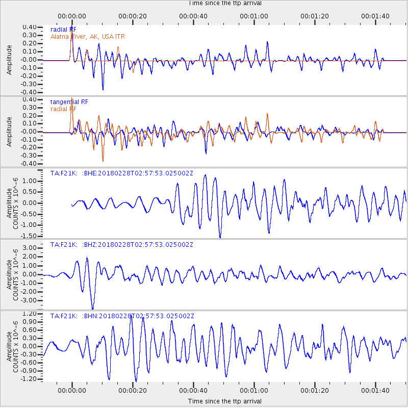
F21K Alatna River, AK, USA - Earthquake Result Viewer
*The percent match for this event was below the threshold and hence no stack was calculated.
| Earthquake location: |
New Guinea, Papua New Guinea |
| Earthquake latitude/longitude: |
-6.2/142.5 |
| Earthquake time(UTC): |
2018/02/28 (059) 02:45:44 GMT |
| Earthquake Depth: |
10 km |
| Earthquake Magnitude: |
6.0 Mww |
| Earthquake Catalog/Contributor: |
NEIC PDE/us |
|
| Network: |
TA USArray Transportable Network (new EarthScope stations) |
| Station: |
F21K Alatna River, AK, USA |
| Lat/Lon: |
67.22 N/153.48 W |
| Elevation: |
597 m |
|
| Distance: |
85.9 deg |
| Az: |
20.547 deg |
| Baz: |
243.668 deg |
| Ray Param: |
$rayparam |
*The percent match for this event was below the threshold and hence was not used in the summary stack. |
|
| Radial Match: |
79.313065 % |
| Radial Bump: |
400 |
| Transverse Match: |
75.90585 % |
| Transverse Bump: |
400 |
| SOD ConfigId: |
13570011 |
| Insert Time: |
2019-04-29 21:29:44.840 +0000 |
| GWidth: |
2.5 |
| Max Bumps: |
400 |
| Tol: |
0.001 |
|
Signal To Noise
| Channel | StoN | STA | LTA |
| TA:F21K: :BHZ:20180228T02:57:53.025002Z | 7.8015647 | 1.0982357E-6 | 1.407712E-7 |
| TA:F21K: :BHN:20180228T02:57:53.025002Z | 1.574981 | 2.1652266E-7 | 1.3747638E-7 |
| TA:F21K: :BHE:20180228T02:57:53.025002Z | 2.1506941 | 3.4045144E-7 | 1.582984E-7 |
| Arrivals |
| Ps | |
| PpPs | |
| PsPs/PpSs | |


