You are here: Home > Network List > TJ - Tajikistan National Seismic Network Stations List
> Station GARM Garm, Tajikistan > Earthquake Result Viewer
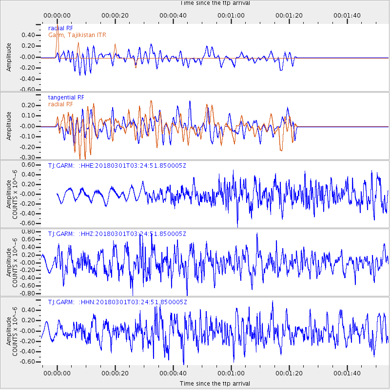
GARM Garm, Tajikistan - Earthquake Result Viewer
*The percent match for this event was below the threshold and hence no stack was calculated.
| Earthquake location: |
Northern Sumatra, Indonesia |
| Earthquake latitude/longitude: |
1.0/98.7 |
| Earthquake time(UTC): |
2018/03/01 (060) 03:17:06 GMT |
| Earthquake Depth: |
71 km |
| Earthquake Magnitude: |
5.2 Mww |
| Earthquake Catalog/Contributor: |
NEIC PDE/us |
|
| Network: |
TJ Tajikistan National Seismic Network |
| Station: |
GARM Garm, Tajikistan |
| Lat/Lon: |
39.00 N/70.32 E |
| Elevation: |
1305 m |
|
| Distance: |
45.9 deg |
| Az: |
328.915 deg |
| Baz: |
138.509 deg |
| Ray Param: |
$rayparam |
*The percent match for this event was below the threshold and hence was not used in the summary stack. |
|
| Radial Match: |
58.485626 % |
| Radial Bump: |
400 |
| Transverse Match: |
54.54138 % |
| Transverse Bump: |
400 |
| SOD ConfigId: |
13570011 |
| Insert Time: |
2019-04-29 21:34:42.411 +0000 |
| GWidth: |
2.5 |
| Max Bumps: |
400 |
| Tol: |
0.001 |
|
Signal To Noise
| Channel | StoN | STA | LTA |
| TJ:GARM: :HHZ:20180301T03:24:51.850005Z | 4.1162634 | 2.8688746E-7 | 6.969609E-8 |
| TJ:GARM: :HHN:20180301T03:24:51.850005Z | 0.7599813 | 9.601295E-8 | 1.2633593E-7 |
| TJ:GARM: :HHE:20180301T03:24:51.850005Z | 1.2895396 | 1.1730023E-7 | 9.096288E-8 |
| Arrivals |
| Ps | |
| PpPs | |
| PsPs/PpSs | |


