You are here: Home > Network List > TA - USArray Transportable Network (new EarthScope stations) Stations List
> Station A21K Barrow, AK, USA > Earthquake Result Viewer
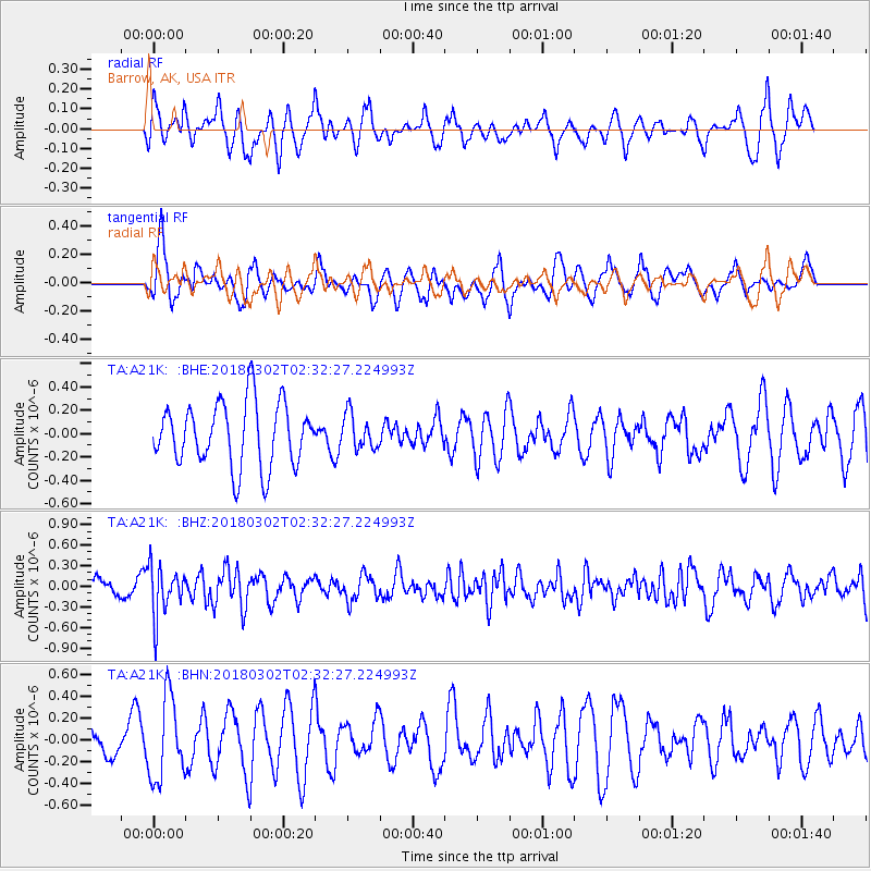
A21K Barrow, AK, USA - Earthquake Result Viewer
*The percent match for this event was below the threshold and hence no stack was calculated.
| Earthquake location: |
Banda Sea |
| Earthquake latitude/longitude: |
-6.2/130.3 |
| Earthquake time(UTC): |
2018/03/02 (061) 02:20:12 GMT |
| Earthquake Depth: |
137 km |
| Earthquake Magnitude: |
5.9 Mww |
| Earthquake Catalog/Contributor: |
NEIC PDE/us |
|
| Network: |
TA USArray Transportable Network (new EarthScope stations) |
| Station: |
A21K Barrow, AK, USA |
| Lat/Lon: |
71.32 N/156.62 W |
| Elevation: |
577 m |
|
| Distance: |
90.5 deg |
| Az: |
17.953 deg |
| Baz: |
252.027 deg |
| Ray Param: |
$rayparam |
*The percent match for this event was below the threshold and hence was not used in the summary stack. |
|
| Radial Match: |
46.392258 % |
| Radial Bump: |
325 |
| Transverse Match: |
59.017532 % |
| Transverse Bump: |
400 |
| SOD ConfigId: |
13570011 |
| Insert Time: |
2019-04-29 21:37:11.725 +0000 |
| GWidth: |
2.5 |
| Max Bumps: |
400 |
| Tol: |
0.001 |
|
Signal To Noise
| Channel | StoN | STA | LTA |
| TA:A21K: :BHZ:20180302T02:32:27.224993Z | 2.8081508 | 3.672526E-7 | 1.3078095E-7 |
| TA:A21K: :BHN:20180302T02:32:27.224993Z | 1.8119864 | 3.758679E-7 | 2.0743417E-7 |
| TA:A21K: :BHE:20180302T02:32:27.224993Z | 0.5381093 | 1.4573716E-7 | 2.708319E-7 |
| Arrivals |
| Ps | |
| PpPs | |
| PsPs/PpSs | |


