You are here: Home > Network List > US - United States National Seismic Network Stations List
> Station EGMT Eagleton, Montana, USA > Earthquake Result Viewer
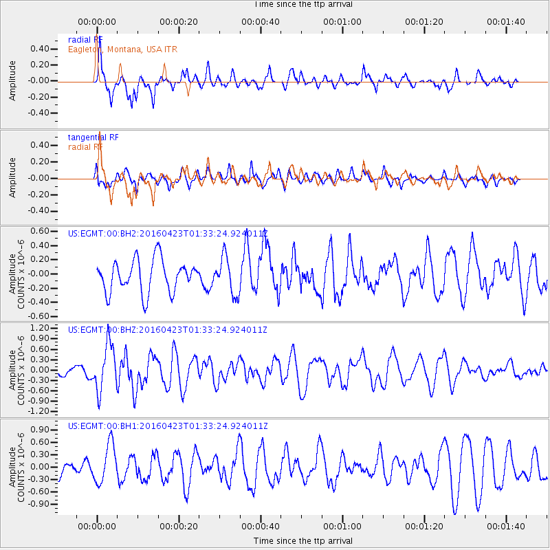
EGMT Eagleton, Montana, USA - Earthquake Result Viewer
*The percent match for this event was below the threshold and hence no stack was calculated.
| Earthquake location: |
Near Coast Of Ecuador |
| Earthquake latitude/longitude: |
0.6/-80.3 |
| Earthquake time(UTC): |
2016/04/23 (114) 01:24:34 GMT |
| Earthquake Depth: |
10 km |
| Earthquake Magnitude: |
5.8 MWP |
| Earthquake Catalog/Contributor: |
NEIC PDE/NEIC COMCAT |
|
| Network: |
US United States National Seismic Network |
| Station: |
EGMT Eagleton, Montana, USA |
| Lat/Lon: |
48.02 N/109.75 W |
| Elevation: |
1055 m |
|
| Distance: |
53.7 deg |
| Az: |
335.796 deg |
| Baz: |
142.36 deg |
| Ray Param: |
$rayparam |
*The percent match for this event was below the threshold and hence was not used in the summary stack. |
|
| Radial Match: |
77.14433 % |
| Radial Bump: |
381 |
| Transverse Match: |
60.780163 % |
| Transverse Bump: |
400 |
| SOD ConfigId: |
1475611 |
| Insert Time: |
2016-05-07 01:32:48.447 +0000 |
| GWidth: |
2.5 |
| Max Bumps: |
400 |
| Tol: |
0.001 |
|
Signal To Noise
| Channel | StoN | STA | LTA |
| US:EGMT:00:BHZ:20160423T01:33:24.924011Z | 7.6526556 | 6.8382025E-7 | 8.935725E-8 |
| US:EGMT:00:BH1:20160423T01:33:24.924011Z | 2.6766953 | 4.773584E-7 | 1.7833871E-7 |
| US:EGMT:00:BH2:20160423T01:33:24.924011Z | 1.1818076 | 2.6779708E-7 | 2.2659954E-7 |
| Arrivals |
| Ps | |
| PpPs | |
| PsPs/PpSs | |


