You are here: Home > Network List > TA - USArray Transportable Network (new EarthScope stations) Stations List
> Station I17K Unalakleet, AK, USA > Earthquake Result Viewer
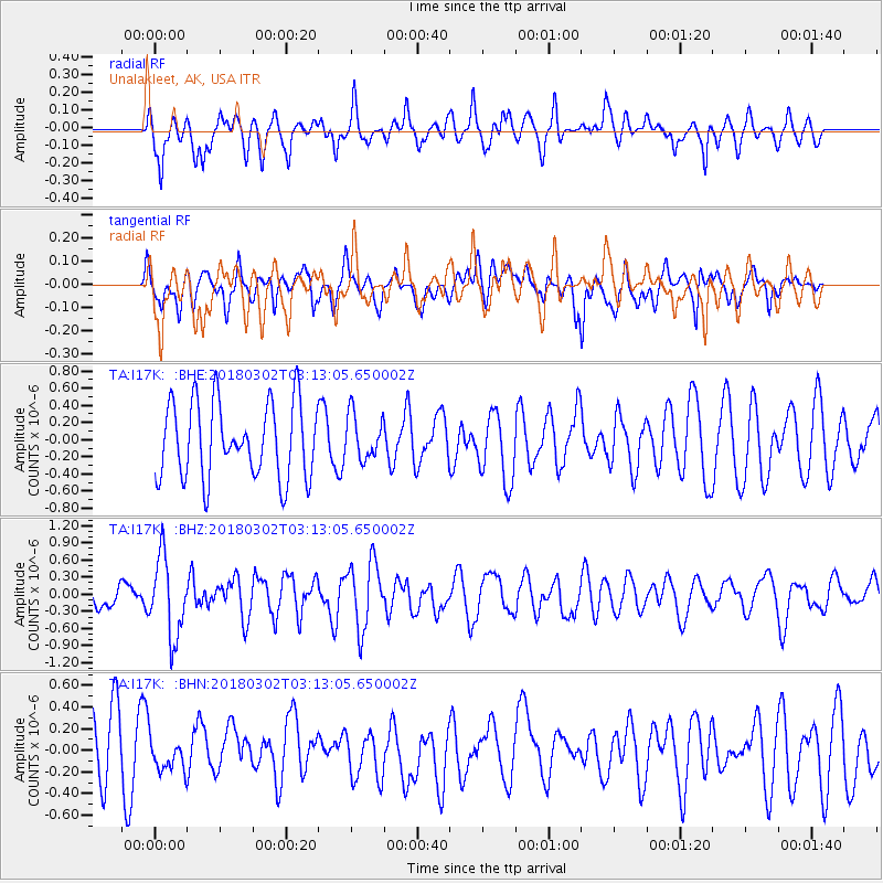
I17K Unalakleet, AK, USA - Earthquake Result Viewer
*The percent match for this event was below the threshold and hence no stack was calculated.
| Earthquake location: |
New Guinea, Papua New Guinea |
| Earthquake latitude/longitude: |
-6.1/142.5 |
| Earthquake time(UTC): |
2018/03/02 (061) 03:01:23 GMT |
| Earthquake Depth: |
29 km |
| Earthquake Magnitude: |
5.6 Mww |
| Earthquake Catalog/Contributor: |
NEIC PDE/us |
|
| Network: |
TA USArray Transportable Network (new EarthScope stations) |
| Station: |
I17K Unalakleet, AK, USA |
| Lat/Lon: |
63.89 N/160.70 W |
| Elevation: |
105 m |
|
| Distance: |
81.5 deg |
| Az: |
21.978 deg |
| Baz: |
237.251 deg |
| Ray Param: |
$rayparam |
*The percent match for this event was below the threshold and hence was not used in the summary stack. |
|
| Radial Match: |
46.224514 % |
| Radial Bump: |
396 |
| Transverse Match: |
57.105267 % |
| Transverse Bump: |
400 |
| SOD ConfigId: |
13570011 |
| Insert Time: |
2019-04-29 21:40:35.805 +0000 |
| GWidth: |
2.5 |
| Max Bumps: |
400 |
| Tol: |
0.001 |
|
Signal To Noise
| Channel | StoN | STA | LTA |
| TA:I17K: :BHZ:20180302T03:13:05.650002Z | 3.068422 | 6.8950806E-7 | 2.2471094E-7 |
| TA:I17K: :BHN:20180302T03:13:05.650002Z | 0.47568008 | 1.6210316E-7 | 3.407819E-7 |
| TA:I17K: :BHE:20180302T03:13:05.650002Z | 0.53717726 | 2.3500868E-7 | 4.3748813E-7 |
| Arrivals |
| Ps | |
| PpPs | |
| PsPs/PpSs | |


