You are here: Home > Network List > US - United States National Seismic Network Stations List
> Station MSO Missoula, Montana, USA > Earthquake Result Viewer
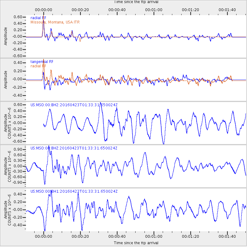
MSO Missoula, Montana, USA - Earthquake Result Viewer
*The percent match for this event was below the threshold and hence no stack was calculated.
| Earthquake location: |
Near Coast Of Ecuador |
| Earthquake latitude/longitude: |
0.6/-80.3 |
| Earthquake time(UTC): |
2016/04/23 (114) 01:24:34 GMT |
| Earthquake Depth: |
10 km |
| Earthquake Magnitude: |
5.8 MWP |
| Earthquake Catalog/Contributor: |
NEIC PDE/NEIC COMCAT |
|
| Network: |
US United States National Seismic Network |
| Station: |
MSO Missoula, Montana, USA |
| Lat/Lon: |
46.83 N/113.94 W |
| Elevation: |
1264 m |
|
| Distance: |
54.6 deg |
| Az: |
332.168 deg |
| Baz: |
137.161 deg |
| Ray Param: |
$rayparam |
*The percent match for this event was below the threshold and hence was not used in the summary stack. |
|
| Radial Match: |
75.077385 % |
| Radial Bump: |
371 |
| Transverse Match: |
54.12786 % |
| Transverse Bump: |
400 |
| SOD ConfigId: |
1475611 |
| Insert Time: |
2016-05-07 01:34:10.750 +0000 |
| GWidth: |
2.5 |
| Max Bumps: |
400 |
| Tol: |
0.001 |
|
Signal To Noise
| Channel | StoN | STA | LTA |
| US:MSO:00:BHZ:20160423T01:33:31.650024Z | 4.742461 | 6.3954064E-7 | 1.3485416E-7 |
| US:MSO:00:BH1:20160423T01:33:31.650024Z | 3.5778565 | 3.338485E-7 | 9.330964E-8 |
| US:MSO:00:BH2:20160423T01:33:31.650024Z | 2.2741876 | 4.3497104E-7 | 1.9126435E-7 |
| Arrivals |
| Ps | |
| PpPs | |
| PsPs/PpSs | |


