You are here: Home > Network List > TA - USArray Transportable Network (new EarthScope stations) Stations List
> Station H16A Russell Place, West Yellowstone, MT, USA > Earthquake Result Viewer
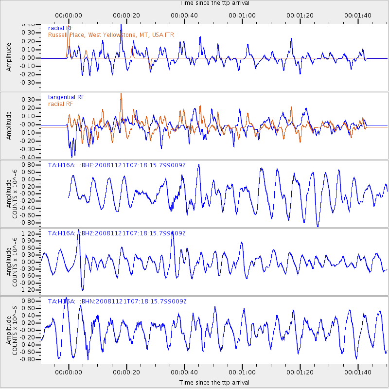
H16A Russell Place, West Yellowstone, MT, USA - Earthquake Result Viewer
*The percent match for this event was below the threshold and hence no stack was calculated.
| Earthquake location: |
Solomon Islands |
| Earthquake latitude/longitude: |
-8.9/159.6 |
| Earthquake time(UTC): |
2008/11/21 (326) 07:05:34 GMT |
| Earthquake Depth: |
118 km |
| Earthquake Magnitude: |
6.0 MB, 6.1 MW, 6.0 MW |
| Earthquake Catalog/Contributor: |
WHDF/NEIC |
|
| Network: |
TA USArray Transportable Network (new EarthScope stations) |
| Station: |
H16A Russell Place, West Yellowstone, MT, USA |
| Lat/Lon: |
44.70 N/111.25 W |
| Elevation: |
2080 m |
|
| Distance: |
95.7 deg |
| Az: |
45.768 deg |
| Baz: |
263.082 deg |
| Ray Param: |
$rayparam |
*The percent match for this event was below the threshold and hence was not used in the summary stack. |
|
| Radial Match: |
72.01667 % |
| Radial Bump: |
400 |
| Transverse Match: |
65.53554 % |
| Transverse Bump: |
400 |
| SOD ConfigId: |
2658 |
| Insert Time: |
2010-03-06 09:32:43.689 +0000 |
| GWidth: |
2.5 |
| Max Bumps: |
400 |
| Tol: |
0.001 |
|
Signal To Noise
| Channel | StoN | STA | LTA |
| TA:H16A: :BHZ:20081121T07:18:15.799009Z | 3.703485 | 6.4336047E-7 | 1.737176E-7 |
| TA:H16A: :BHN:20081121T07:18:15.799009Z | 3.7997565 | 5.700288E-7 | 1.500172E-7 |
| TA:H16A: :BHE:20081121T07:18:15.799009Z | 0.828242 | 2.2894439E-7 | 2.7642207E-7 |
| Arrivals |
| Ps | |
| PpPs | |
| PsPs/PpSs | |


