You are here: Home > Network List > TA - USArray Transportable Network (new EarthScope stations) Stations List
> Station G21K Allakaket, AK, USA > Earthquake Result Viewer
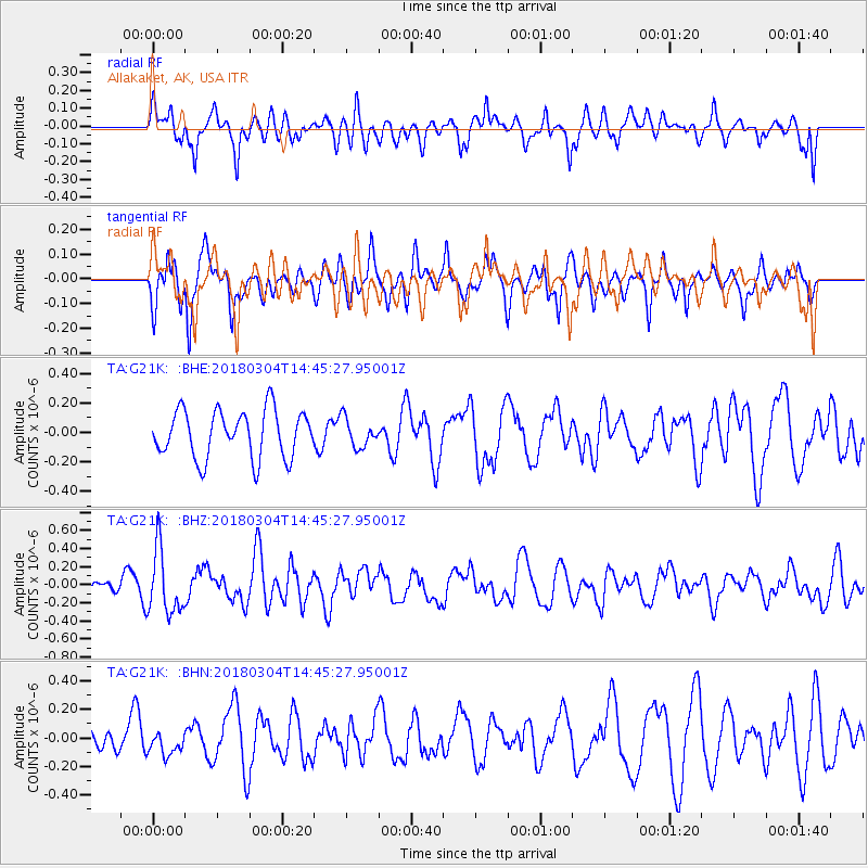
G21K Allakaket, AK, USA - Earthquake Result Viewer
*The percent match for this event was below the threshold and hence no stack was calculated.
| Earthquake location: |
New Guinea, Papua New Guinea |
| Earthquake latitude/longitude: |
-6.1/142.7 |
| Earthquake time(UTC): |
2018/03/04 (063) 14:33:21 GMT |
| Earthquake Depth: |
6.0 km |
| Earthquake Magnitude: |
5.7 Mww |
| Earthquake Catalog/Contributor: |
NEIC PDE/us |
|
| Network: |
TA USArray Transportable Network (new EarthScope stations) |
| Station: |
G21K Allakaket, AK, USA |
| Lat/Lon: |
66.52 N/153.51 W |
| Elevation: |
446 m |
|
| Distance: |
85.4 deg |
| Az: |
21.14 deg |
| Baz: |
243.5 deg |
| Ray Param: |
$rayparam |
*The percent match for this event was below the threshold and hence was not used in the summary stack. |
|
| Radial Match: |
61.0265 % |
| Radial Bump: |
400 |
| Transverse Match: |
59.976444 % |
| Transverse Bump: |
336 |
| SOD ConfigId: |
13570011 |
| Insert Time: |
2019-04-29 21:51:37.865 +0000 |
| GWidth: |
2.5 |
| Max Bumps: |
400 |
| Tol: |
0.001 |
|
Signal To Noise
| Channel | StoN | STA | LTA |
| TA:G21K: :BHZ:20180304T14:45:27.95001Z | 3.7340307 | 3.5849777E-7 | 9.600826E-8 |
| TA:G21K: :BHN:20180304T14:45:27.95001Z | 0.6630054 | 8.1720785E-8 | 1.2325809E-7 |
| TA:G21K: :BHE:20180304T14:45:27.95001Z | 0.60016006 | 9.667681E-8 | 1.6108503E-7 |
| Arrivals |
| Ps | |
| PpPs | |
| PsPs/PpSs | |


