You are here: Home > Network List > TA - USArray Transportable Network (new EarthScope stations) Stations List
> Station H16A Russell Place, West Yellowstone, MT, USA > Earthquake Result Viewer
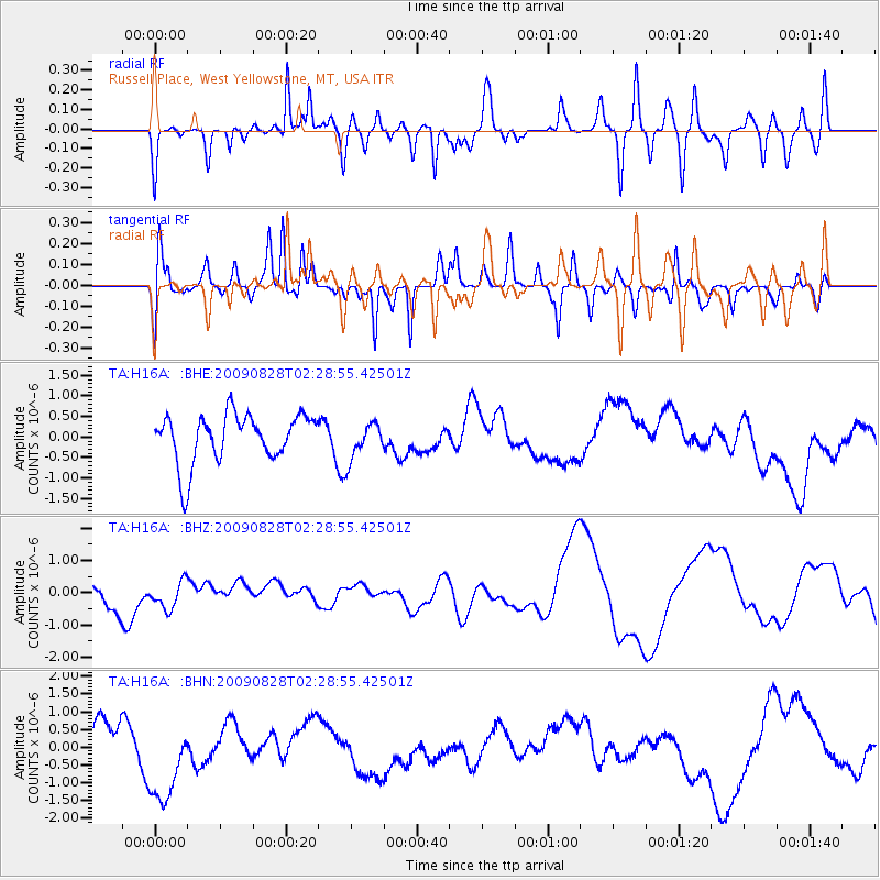
H16A Russell Place, West Yellowstone, MT, USA - Earthquake Result Viewer
*The percent match for this event was below the threshold and hence no stack was calculated.
| Earthquake location: |
Qinghai, China |
| Earthquake latitude/longitude: |
37.7/95.8 |
| Earthquake time(UTC): |
2009/08/28 (240) 02:16:08 GMT |
| Earthquake Depth: |
16 km |
| Earthquake Magnitude: |
5.6 MB |
| Earthquake Catalog/Contributor: |
WHDF/NEIC |
|
| Network: |
TA USArray Transportable Network (new EarthScope stations) |
| Station: |
H16A Russell Place, West Yellowstone, MT, USA |
| Lat/Lon: |
44.70 N/111.25 W |
| Elevation: |
2080 m |
|
| Distance: |
94.4 deg |
| Az: |
18.959 deg |
| Baz: |
338.809 deg |
| Ray Param: |
$rayparam |
*The percent match for this event was below the threshold and hence was not used in the summary stack. |
|
| Radial Match: |
52.11723 % |
| Radial Bump: |
400 |
| Transverse Match: |
61.383934 % |
| Transverse Bump: |
349 |
| SOD ConfigId: |
2622 |
| Insert Time: |
2010-03-06 09:33:03.250 +0000 |
| GWidth: |
2.5 |
| Max Bumps: |
400 |
| Tol: |
0.001 |
|
Signal To Noise
| Channel | StoN | STA | LTA |
| TA:H16A: :BHZ:20090828T02:28:55.42501Z | 0.7557572 | 4.137636E-7 | 5.4748216E-7 |
| TA:H16A: :BHN:20090828T02:28:55.42501Z | 2.0855744 | 1.2463189E-6 | 5.9759026E-7 |
| TA:H16A: :BHE:20090828T02:28:55.42501Z | 0.7574826 | 4.5233003E-7 | 5.971491E-7 |
| Arrivals |
| Ps | |
| PpPs | |
| PsPs/PpSs | |


