You are here: Home > Network List > TA - USArray Transportable Network (new EarthScope stations) Stations List
> Station H16A Russell Place, West Yellowstone, MT, USA > Earthquake Result Viewer
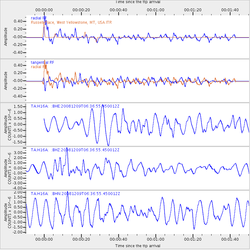
H16A Russell Place, West Yellowstone, MT, USA - Earthquake Result Viewer
*The percent match for this event was below the threshold and hence no stack was calculated.
| Earthquake location: |
Kermadec Islands Region |
| Earthquake latitude/longitude: |
-31.2/-176.9 |
| Earthquake time(UTC): |
2008/12/09 (344) 06:23:59 GMT |
| Earthquake Depth: |
18 km |
| Earthquake Magnitude: |
6.2 MB, 6.7 MS, 6.8 MW, 6.7 MW |
| Earthquake Catalog/Contributor: |
WHDF/NEIC |
|
| Network: |
TA USArray Transportable Network (new EarthScope stations) |
| Station: |
H16A Russell Place, West Yellowstone, MT, USA |
| Lat/Lon: |
44.70 N/111.25 W |
| Elevation: |
2080 m |
|
| Distance: |
96.3 deg |
| Az: |
40.828 deg |
| Baz: |
231.753 deg |
| Ray Param: |
$rayparam |
*The percent match for this event was below the threshold and hence was not used in the summary stack. |
|
| Radial Match: |
78.116684 % |
| Radial Bump: |
400 |
| Transverse Match: |
52.067825 % |
| Transverse Bump: |
400 |
| SOD ConfigId: |
2658 |
| Insert Time: |
2010-03-06 09:33:27.546 +0000 |
| GWidth: |
2.5 |
| Max Bumps: |
400 |
| Tol: |
0.001 |
|
Signal To Noise
| Channel | StoN | STA | LTA |
| TA:H16A: :BHZ:20081209T06:36:55.450012Z | 2.8139813 | 1.3427069E-6 | 4.771556E-7 |
| TA:H16A: :BHN:20081209T06:36:55.450012Z | 1.5816125 | 1.0221419E-6 | 6.4626573E-7 |
| TA:H16A: :BHE:20081209T06:36:55.450012Z | 2.7780843 | 1.1865872E-6 | 4.2712423E-7 |
| Arrivals |
| Ps | |
| PpPs | |
| PsPs/PpSs | |


