You are here: Home > Network List > TA - USArray Transportable Network (new EarthScope stations) Stations List
> Station D25K Kavik River, AK, USA > Earthquake Result Viewer
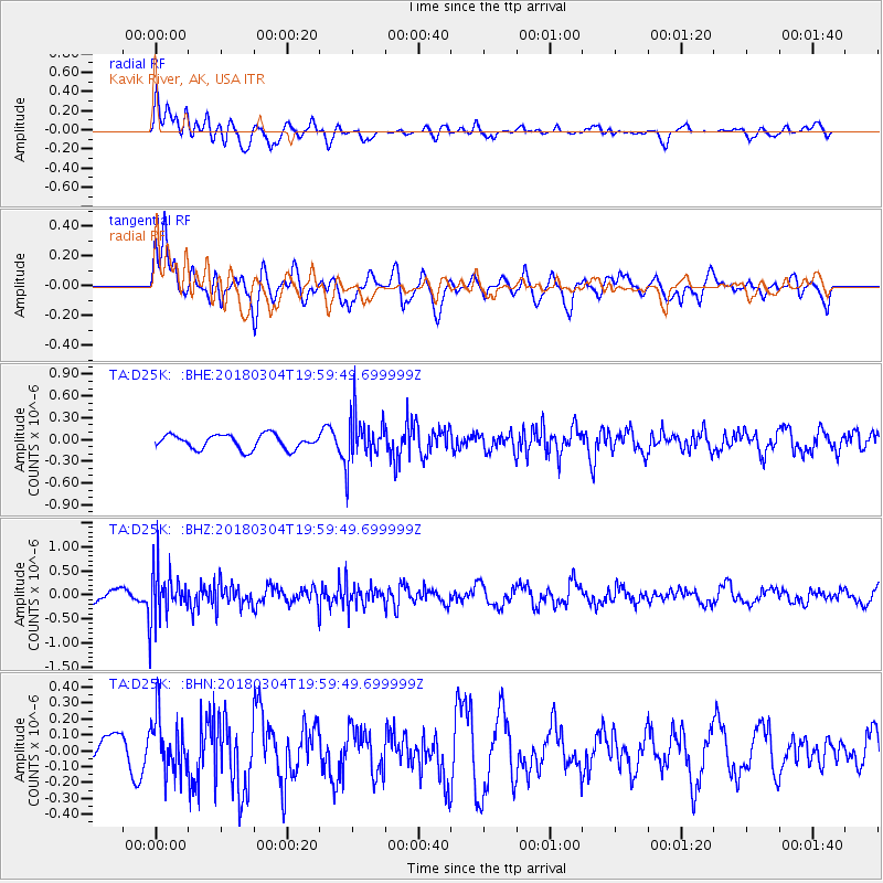
D25K Kavik River, AK, USA - Earthquake Result Viewer
*The percent match for this event was below the threshold and hence no stack was calculated.
| Earthquake location: |
Kuril Islands |
| Earthquake latitude/longitude: |
45.1/147.8 |
| Earthquake time(UTC): |
2018/03/04 (063) 19:52:52 GMT |
| Earthquake Depth: |
104 km |
| Earthquake Magnitude: |
5.4 Mww |
| Earthquake Catalog/Contributor: |
NEIC PDE/us |
|
| Network: |
TA USArray Transportable Network (new EarthScope stations) |
| Station: |
D25K Kavik River, AK, USA |
| Lat/Lon: |
69.32 N/146.38 W |
| Elevation: |
770 m |
|
| Distance: |
40.3 deg |
| Az: |
30.058 deg |
| Baz: |
268.167 deg |
| Ray Param: |
$rayparam |
*The percent match for this event was below the threshold and hence was not used in the summary stack. |
|
| Radial Match: |
59.45819 % |
| Radial Bump: |
400 |
| Transverse Match: |
70.28915 % |
| Transverse Bump: |
400 |
| SOD ConfigId: |
13570011 |
| Insert Time: |
2019-04-29 22:01:10.773 +0000 |
| GWidth: |
2.5 |
| Max Bumps: |
400 |
| Tol: |
0.001 |
|
Signal To Noise
| Channel | StoN | STA | LTA |
| TA:D25K: :BHZ:20180304T19:59:49.699999Z | 3.1820712 | 5.422701E-7 | 1.7041418E-7 |
| TA:D25K: :BHN:20180304T19:59:49.699999Z | 1.6468046 | 1.8121776E-7 | 1.1004205E-7 |
| TA:D25K: :BHE:20180304T19:59:49.699999Z | 3.389293 | 3.3352728E-7 | 9.8406154E-8 |
| Arrivals |
| Ps | |
| PpPs | |
| PsPs/PpSs | |


