You are here: Home > Network List > TA - USArray Transportable Network (new EarthScope stations) Stations List
> Station H16A Russell Place, West Yellowstone, MT, USA > Earthquake Result Viewer
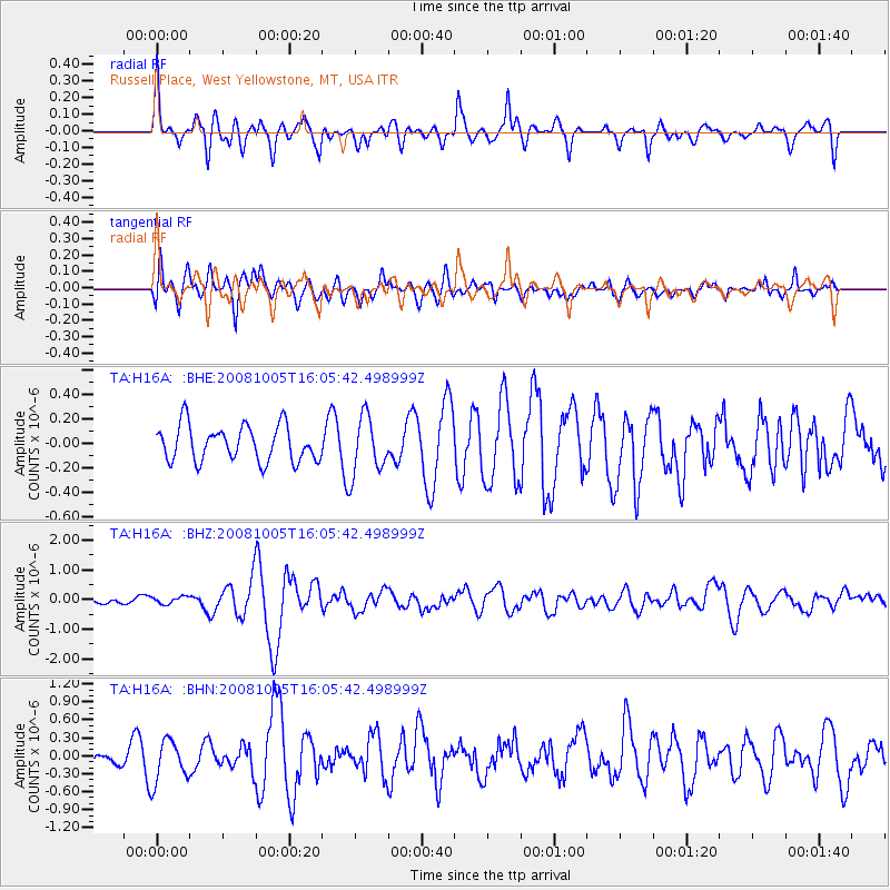
H16A Russell Place, West Yellowstone, MT, USA - Earthquake Result Viewer
*The percent match for this event was below the threshold and hence no stack was calculated.
| Earthquake location: |
Tajikistan-Xinjiang Border Reg. |
| Earthquake latitude/longitude: |
39.5/73.8 |
| Earthquake time(UTC): |
2008/10/05 (279) 15:52:49 GMT |
| Earthquake Depth: |
27 km |
| Earthquake Magnitude: |
6.4 MB, 6.9 MS, 6.6 MW, 6.6 MW |
| Earthquake Catalog/Contributor: |
WHDF/NEIC |
|
| Network: |
TA USArray Transportable Network (new EarthScope stations) |
| Station: |
H16A Russell Place, West Yellowstone, MT, USA |
| Lat/Lon: |
44.70 N/111.25 W |
| Elevation: |
2080 m |
|
| Distance: |
96.0 deg |
| Az: |
3.635 deg |
| Baz: |
356.058 deg |
| Ray Param: |
$rayparam |
*The percent match for this event was below the threshold and hence was not used in the summary stack. |
|
| Radial Match: |
65.50485 % |
| Radial Bump: |
400 |
| Transverse Match: |
68.99245 % |
| Transverse Bump: |
400 |
| SOD ConfigId: |
2560 |
| Insert Time: |
2010-03-06 09:34:56.963 +0000 |
| GWidth: |
2.5 |
| Max Bumps: |
400 |
| Tol: |
0.001 |
|
Signal To Noise
| Channel | StoN | STA | LTA |
| TA:H16A: :BHZ:20081005T16:05:42.498999Z | 0.7553073 | 1.2326261E-7 | 1.6319531E-7 |
| TA:H16A: :BHN:20081005T16:05:42.498999Z | 2.8233843 | 3.5249755E-7 | 1.2484931E-7 |
| TA:H16A: :BHE:20081005T16:05:42.498999Z | 1.6128432 | 2.3472543E-7 | 1.455352E-7 |
| Arrivals |
| Ps | |
| PpPs | |
| PsPs/PpSs | |


