You are here: Home > Network List > TA - USArray Transportable Network (new EarthScope stations) Stations List
> Station MDND Maddock, ND, USA > Earthquake Result Viewer
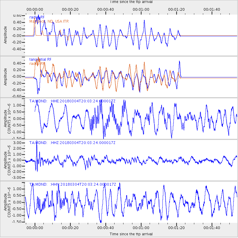
MDND Maddock, ND, USA - Earthquake Result Viewer
*The percent match for this event was below the threshold and hence no stack was calculated.
| Earthquake location: |
Kuril Islands |
| Earthquake latitude/longitude: |
45.1/147.8 |
| Earthquake time(UTC): |
2018/03/04 (063) 19:52:52 GMT |
| Earthquake Depth: |
104 km |
| Earthquake Magnitude: |
5.4 Mww |
| Earthquake Catalog/Contributor: |
NEIC PDE/us |
|
| Network: |
TA USArray Transportable Network (new EarthScope stations) |
| Station: |
MDND Maddock, ND, USA |
| Lat/Lon: |
47.85 N/99.60 W |
| Elevation: |
479 m |
|
| Distance: |
70.3 deg |
| Az: |
41.352 deg |
| Baz: |
315.955 deg |
| Ray Param: |
$rayparam |
*The percent match for this event was below the threshold and hence was not used in the summary stack. |
|
| Radial Match: |
61.589207 % |
| Radial Bump: |
400 |
| Transverse Match: |
62.665157 % |
| Transverse Bump: |
400 |
| SOD ConfigId: |
13570011 |
| Insert Time: |
2019-04-29 22:02:10.016 +0000 |
| GWidth: |
2.5 |
| Max Bumps: |
400 |
| Tol: |
0.001 |
|
Signal To Noise
| Channel | StoN | STA | LTA |
| TA:MDND: :HHZ:20180304T20:03:24.000017Z | 2.142741 | 9.870888E-7 | 4.6066646E-7 |
| TA:MDND: :HHN:20180304T20:03:24.000017Z | 1.0393463 | 5.6996083E-7 | 5.48384E-7 |
| TA:MDND: :HHE:20180304T20:03:24.000017Z | 0.82084715 | 5.3485866E-7 | 6.515935E-7 |
| Arrivals |
| Ps | |
| PpPs | |
| PsPs/PpSs | |


