You are here: Home > Network List > TA - USArray Transportable Network (new EarthScope stations) Stations List
> Station R33M Jennings River, BC, CAN > Earthquake Result Viewer
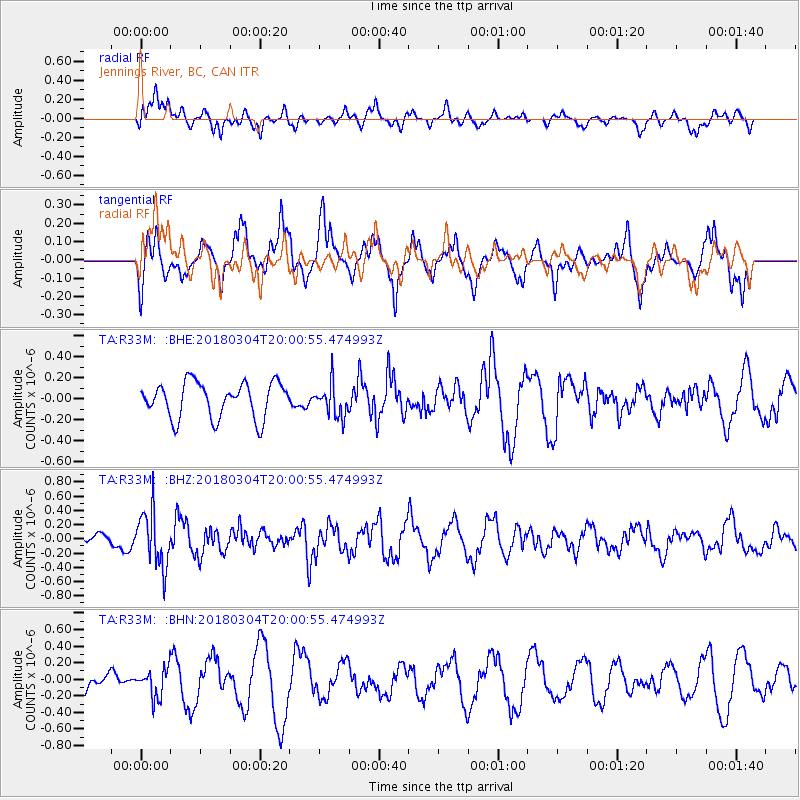
R33M Jennings River, BC, CAN - Earthquake Result Viewer
*The percent match for this event was below the threshold and hence no stack was calculated.
| Earthquake location: |
Kuril Islands |
| Earthquake latitude/longitude: |
45.1/147.8 |
| Earthquake time(UTC): |
2018/03/04 (063) 19:52:52 GMT |
| Earthquake Depth: |
104 km |
| Earthquake Magnitude: |
5.4 Mww |
| Earthquake Catalog/Contributor: |
NEIC PDE/us |
|
| Network: |
TA USArray Transportable Network (new EarthScope stations) |
| Station: |
R33M Jennings River, BC, CAN |
| Lat/Lon: |
59.39 N/130.97 W |
| Elevation: |
1437 m |
|
| Distance: |
48.6 deg |
| Az: |
42.388 deg |
| Baz: |
290.949 deg |
| Ray Param: |
$rayparam |
*The percent match for this event was below the threshold and hence was not used in the summary stack. |
|
| Radial Match: |
47.611088 % |
| Radial Bump: |
400 |
| Transverse Match: |
74.773636 % |
| Transverse Bump: |
379 |
| SOD ConfigId: |
13570011 |
| Insert Time: |
2019-04-29 22:02:24.171 +0000 |
| GWidth: |
2.5 |
| Max Bumps: |
400 |
| Tol: |
0.001 |
|
Signal To Noise
| Channel | StoN | STA | LTA |
| TA:R33M: :BHZ:20180304T20:00:55.474993Z | 3.0537531 | 3.883342E-7 | 1.271662E-7 |
| TA:R33M: :BHN:20180304T20:00:55.474993Z | 1.0335538 | 1.7243893E-7 | 1.6684078E-7 |
| TA:R33M: :BHE:20180304T20:00:55.474993Z | 0.9228872 | 1.554688E-7 | 1.6845915E-7 |
| Arrivals |
| Ps | |
| PpPs | |
| PsPs/PpSs | |


