You are here: Home > Network List > TA - USArray Transportable Network (new EarthScope stations) Stations List
> Station G16K Koyuk River, AK, USA > Earthquake Result Viewer
G16K Koyuk River, AK, USA - Earthquake Result Viewer

| Earthquake location: |
New Guinea, Papua New Guinea |
| Earthquake latitude/longitude: |
-6.3/142.6 |
| Earthquake time(UTC): |
2018/03/06 (065) 14:13:06 GMT |
| Earthquake Depth: |
10 km |
| Earthquake Magnitude: |
6.7 Mww |
| Earthquake Catalog/Contributor: |
NEIC PDE/us |
|
| Network: |
TA USArray Transportable Network (new EarthScope stations) |
| Station: |
G16K Koyuk River, AK, USA |
| Lat/Lon: |
65.39 N/162.35 W |
| Elevation: |
169 m |
|
| Distance: |
82.0 deg |
| Az: |
20.275 deg |
| Baz: |
235.357 deg |
| Ray Param: |
0.047210086 |
| Estimated Moho Depth: |
25.5 km |
| Estimated Crust Vp/Vs: |
1.92 |
| Assumed Crust Vp: |
6.276 km/s |
| Estimated Crust Vs: |
3.264 km/s |
| Estimated Crust Poisson's Ratio: |
0.31 |
|
| Radial Match: |
93.4858 % |
| Radial Bump: |
400 |
| Transverse Match: |
81.200264 % |
| Transverse Bump: |
400 |
| SOD ConfigId: |
13570011 |
| Insert Time: |
2019-04-29 22:12:13.523 +0000 |
| GWidth: |
2.5 |
| Max Bumps: |
400 |
| Tol: |
0.001 |
|
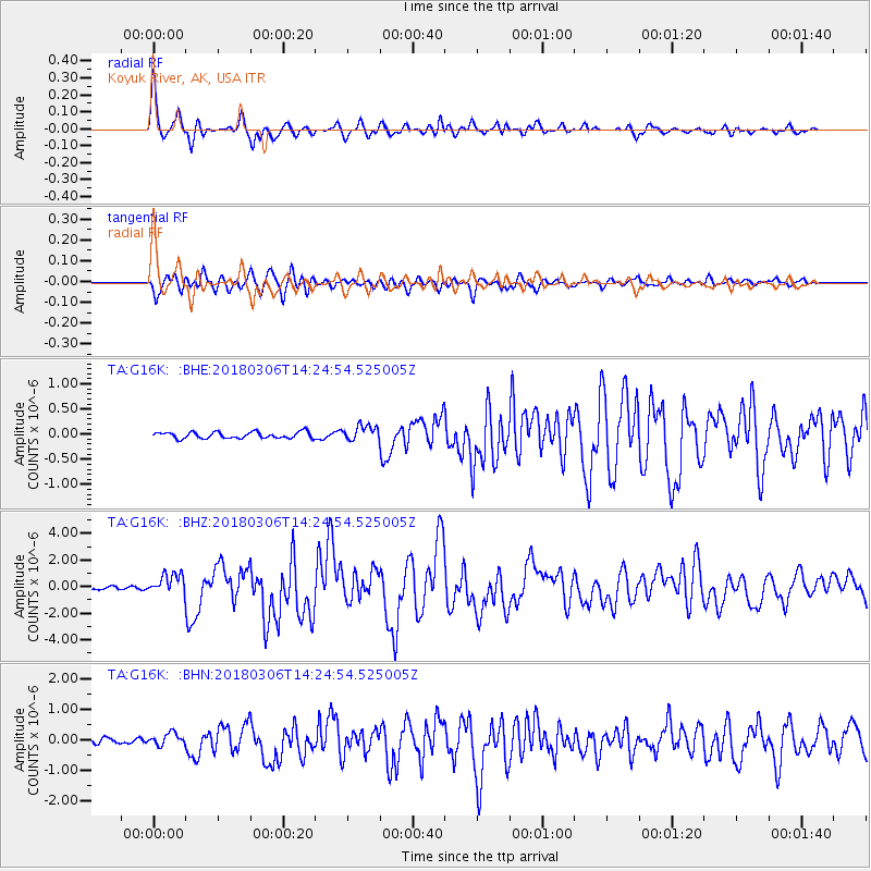
Signal To Noise
| Channel | StoN | STA | LTA |
| TA:G16K: :BHZ:20180306T14:24:54.525005Z | 5.580726 | 7.6696665E-7 | 1.3743133E-7 |
| TA:G16K: :BHN:20180306T14:24:54.525005Z | 1.142339 | 2.0050204E-7 | 1.7551886E-7 |
| TA:G16K: :BHE:20180306T14:24:54.525005Z | 2.3922276 | 1.5046176E-7 | 6.2896085E-8 |
| Arrivals |
| Ps | 3.8 SECOND |
| PpPs | 12 SECOND |
| PsPs/PpSs | 15 SECOND |


