You are here: Home > Network List > G - GEOSCOPE Stations List
> Station MPG Montagne des Peres, French Guyana > Earthquake Result Viewer
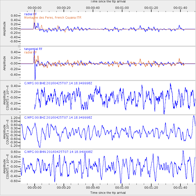
MPG Montagne des Peres, French Guyana - Earthquake Result Viewer
*The percent match for this event was below the threshold and hence no stack was calculated.
| Earthquake location: |
Near Coast Of Chiapas, Mexico |
| Earthquake latitude/longitude: |
14.4/-93.1 |
| Earthquake time(UTC): |
2016/04/25 (116) 07:07:09 GMT |
| Earthquake Depth: |
26 km |
| Earthquake Magnitude: |
5.6 MB |
| Earthquake Catalog/Contributor: |
NEIC PDE/NEIC COMCAT |
|
| Network: |
G GEOSCOPE |
| Station: |
MPG Montagne des Peres, French Guyana |
| Lat/Lon: |
5.11 N/52.64 W |
| Elevation: |
147 m |
|
| Distance: |
40.9 deg |
| Az: |
98.941 deg |
| Baz: |
286.068 deg |
| Ray Param: |
$rayparam |
*The percent match for this event was below the threshold and hence was not used in the summary stack. |
|
| Radial Match: |
66.48716 % |
| Radial Bump: |
400 |
| Transverse Match: |
64.47547 % |
| Transverse Bump: |
400 |
| SOD ConfigId: |
1475611 |
| Insert Time: |
2016-05-09 07:08:16.987 +0000 |
| GWidth: |
2.5 |
| Max Bumps: |
400 |
| Tol: |
0.001 |
|
Signal To Noise
| Channel | StoN | STA | LTA |
| G:MPG:00:BHZ:20160425T07:14:18.949998Z | 2.522094 | 7.4334963E-7 | 2.9473512E-7 |
| G:MPG:00:BHN:20160425T07:14:18.949998Z | 1.0558976 | 2.0210254E-7 | 1.9140354E-7 |
| G:MPG:00:BHE:20160425T07:14:18.949998Z | 1.5664496 | 2.5499259E-7 | 1.6278376E-7 |
| Arrivals |
| Ps | |
| PpPs | |
| PsPs/PpSs | |


