You are here: Home > Network List > CI - Caltech Regional Seismic Network Stations List
> Station MPP McPhearson Peak > Earthquake Result Viewer
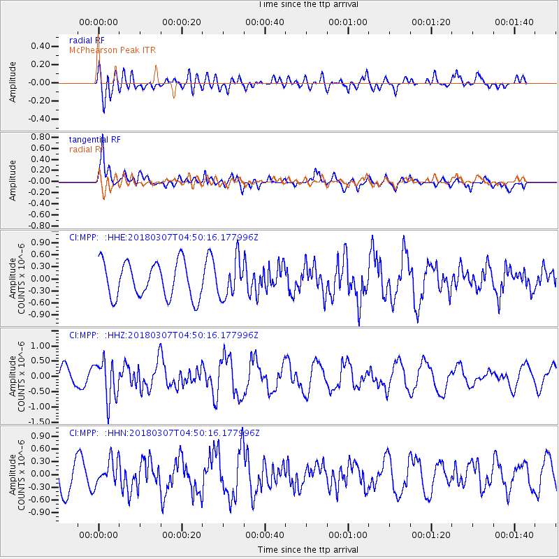
MPP McPhearson Peak - Earthquake Result Viewer
*The percent match for this event was below the threshold and hence no stack was calculated.
| Earthquake location: |
East Of Kuril Islands |
| Earthquake latitude/longitude: |
45.8/152.3 |
| Earthquake time(UTC): |
2018/03/07 (066) 04:40:12 GMT |
| Earthquake Depth: |
29 km |
| Earthquake Magnitude: |
5.8 Mww |
| Earthquake Catalog/Contributor: |
NEIC PDE/us |
|
| Network: |
CI Caltech Regional Seismic Network |
| Station: |
MPP McPhearson Peak |
| Lat/Lon: |
34.89 N/119.81 W |
| Elevation: |
1739 m |
|
| Distance: |
64.7 deg |
| Az: |
65.373 deg |
| Baz: |
309.354 deg |
| Ray Param: |
$rayparam |
*The percent match for this event was below the threshold and hence was not used in the summary stack. |
|
| Radial Match: |
52.018963 % |
| Radial Bump: |
400 |
| Transverse Match: |
67.02789 % |
| Transverse Bump: |
400 |
| SOD ConfigId: |
13570011 |
| Insert Time: |
2019-04-29 22:17:29.828 +0000 |
| GWidth: |
2.5 |
| Max Bumps: |
400 |
| Tol: |
0.001 |
|
Signal To Noise
| Channel | StoN | STA | LTA |
| CI:MPP: :HHZ:20180307T04:50:16.177996Z | 1.9872127 | 6.5172424E-7 | 3.2795896E-7 |
| CI:MPP: :HHN:20180307T04:50:16.177996Z | 0.65697646 | 2.9473728E-7 | 4.4862682E-7 |
| CI:MPP: :HHE:20180307T04:50:16.177996Z | 1.0731484 | 4.7292693E-7 | 4.4069108E-7 |
| Arrivals |
| Ps | |
| PpPs | |
| PsPs/PpSs | |


