You are here: Home > Network List > US - United States National Seismic Network Stations List
> Station DGMT Dagmar, Montana, USA > Earthquake Result Viewer
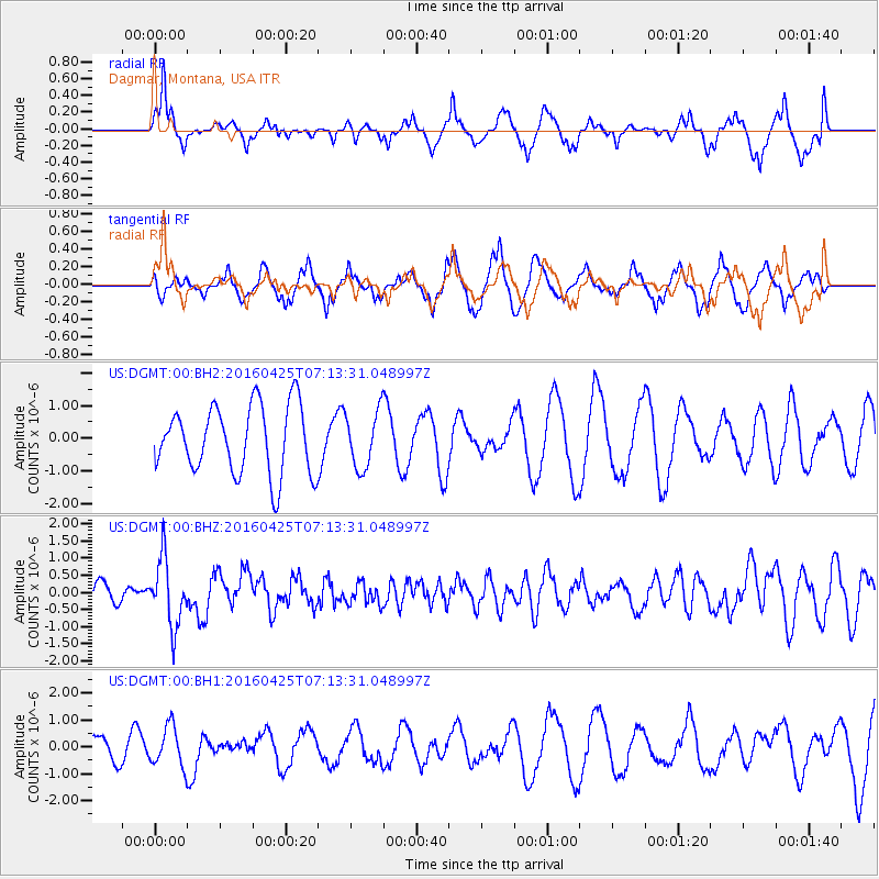
DGMT Dagmar, Montana, USA - Earthquake Result Viewer
*The percent match for this event was below the threshold and hence no stack was calculated.
| Earthquake location: |
Near Coast Of Chiapas, Mexico |
| Earthquake latitude/longitude: |
14.4/-93.1 |
| Earthquake time(UTC): |
2016/04/25 (116) 07:07:09 GMT |
| Earthquake Depth: |
26 km |
| Earthquake Magnitude: |
5.6 MB |
| Earthquake Catalog/Contributor: |
NEIC PDE/NEIC COMCAT |
|
| Network: |
US United States National Seismic Network |
| Station: |
DGMT Dagmar, Montana, USA |
| Lat/Lon: |
48.47 N/104.20 W |
| Elevation: |
0.0 m |
|
| Distance: |
35.2 deg |
| Az: |
347.162 deg |
| Baz: |
161.126 deg |
| Ray Param: |
$rayparam |
*The percent match for this event was below the threshold and hence was not used in the summary stack. |
|
| Radial Match: |
62.210243 % |
| Radial Bump: |
303 |
| Transverse Match: |
43.665108 % |
| Transverse Bump: |
316 |
| SOD ConfigId: |
1475611 |
| Insert Time: |
2016-05-09 07:12:27.195 +0000 |
| GWidth: |
2.5 |
| Max Bumps: |
400 |
| Tol: |
0.001 |
|
Signal To Noise
| Channel | StoN | STA | LTA |
| US:DGMT:00:BHZ:20160425T07:13:31.048997Z | 4.832139 | 9.768152E-7 | 2.0214964E-7 |
| US:DGMT:00:BH1:20160425T07:13:31.048997Z | 1.8917809 | 7.437904E-7 | 3.9316942E-7 |
| US:DGMT:00:BH2:20160425T07:13:31.048997Z | 0.83202726 | 8.633989E-7 | 1.037705E-6 |
| Arrivals |
| Ps | |
| PpPs | |
| PsPs/PpSs | |


