You are here: Home > Network List > US - United States National Seismic Network Stations List
> Station EGMT Eagleton, Montana, USA > Earthquake Result Viewer
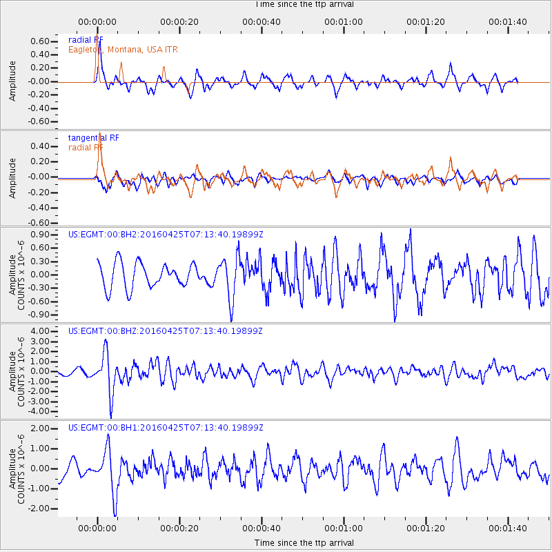
EGMT Eagleton, Montana, USA - Earthquake Result Viewer
*The percent match for this event was below the threshold and hence no stack was calculated.
| Earthquake location: |
Near Coast Of Chiapas, Mexico |
| Earthquake latitude/longitude: |
14.4/-93.1 |
| Earthquake time(UTC): |
2016/04/25 (116) 07:07:09 GMT |
| Earthquake Depth: |
26 km |
| Earthquake Magnitude: |
5.6 MB |
| Earthquake Catalog/Contributor: |
NEIC PDE/NEIC COMCAT |
|
| Network: |
US United States National Seismic Network |
| Station: |
EGMT Eagleton, Montana, USA |
| Lat/Lon: |
48.02 N/109.75 W |
| Elevation: |
1055 m |
|
| Distance: |
36.2 deg |
| Az: |
341.017 deg |
| Baz: |
151.997 deg |
| Ray Param: |
$rayparam |
*The percent match for this event was below the threshold and hence was not used in the summary stack. |
|
| Radial Match: |
73.462524 % |
| Radial Bump: |
346 |
| Transverse Match: |
62.518715 % |
| Transverse Bump: |
400 |
| SOD ConfigId: |
1475611 |
| Insert Time: |
2016-05-09 07:12:38.624 +0000 |
| GWidth: |
2.5 |
| Max Bumps: |
400 |
| Tol: |
0.001 |
|
Signal To Noise
| Channel | StoN | STA | LTA |
| US:EGMT:00:BHZ:20160425T07:13:40.19899Z | 8.050481 | 1.9915428E-6 | 2.4738185E-7 |
| US:EGMT:00:BH1:20160425T07:13:40.19899Z | 2.2202408 | 1.124654E-6 | 5.06546E-7 |
| US:EGMT:00:BH2:20160425T07:13:40.19899Z | 1.770819 | 4.855694E-7 | 2.7420614E-7 |
| Arrivals |
| Ps | |
| PpPs | |
| PsPs/PpSs | |


