You are here: Home > Network List > TA - USArray Transportable Network (new EarthScope stations) Stations List
> Station A21K Barrow, AK, USA > Earthquake Result Viewer
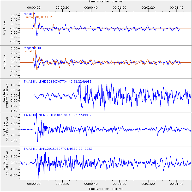
A21K Barrow, AK, USA - Earthquake Result Viewer
*The percent match for this event was below the threshold and hence no stack was calculated.
| Earthquake location: |
East Of Kuril Islands |
| Earthquake latitude/longitude: |
45.8/152.3 |
| Earthquake time(UTC): |
2018/03/07 (066) 04:40:12 GMT |
| Earthquake Depth: |
29 km |
| Earthquake Magnitude: |
5.8 Mww |
| Earthquake Catalog/Contributor: |
NEIC PDE/us |
|
| Network: |
TA USArray Transportable Network (new EarthScope stations) |
| Station: |
A21K Barrow, AK, USA |
| Lat/Lon: |
71.32 N/156.62 W |
| Elevation: |
577 m |
|
| Distance: |
35.1 deg |
| Az: |
25.857 deg |
| Baz: |
251.181 deg |
| Ray Param: |
$rayparam |
*The percent match for this event was below the threshold and hence was not used in the summary stack. |
|
| Radial Match: |
77.21184 % |
| Radial Bump: |
379 |
| Transverse Match: |
74.892746 % |
| Transverse Bump: |
400 |
| SOD ConfigId: |
13570011 |
| Insert Time: |
2019-04-29 22:23:37.188 +0000 |
| GWidth: |
2.5 |
| Max Bumps: |
400 |
| Tol: |
0.001 |
|
Signal To Noise
| Channel | StoN | STA | LTA |
| TA:A21K: :BHZ:20180307T04:46:32.224993Z | 16.108097 | 1.9082852E-6 | 1.1846745E-7 |
| TA:A21K: :BHN:20180307T04:46:32.224993Z | 4.402275 | 7.622288E-7 | 1.731443E-7 |
| TA:A21K: :BHE:20180307T04:46:32.224993Z | 5.043805 | 7.3767404E-7 | 1.4625348E-7 |
| Arrivals |
| Ps | |
| PpPs | |
| PsPs/PpSs | |


