You are here: Home > Network List > TA - USArray Transportable Network (new EarthScope stations) Stations List
> Station I30M Mount Dempster, Yukon, CAN > Earthquake Result Viewer
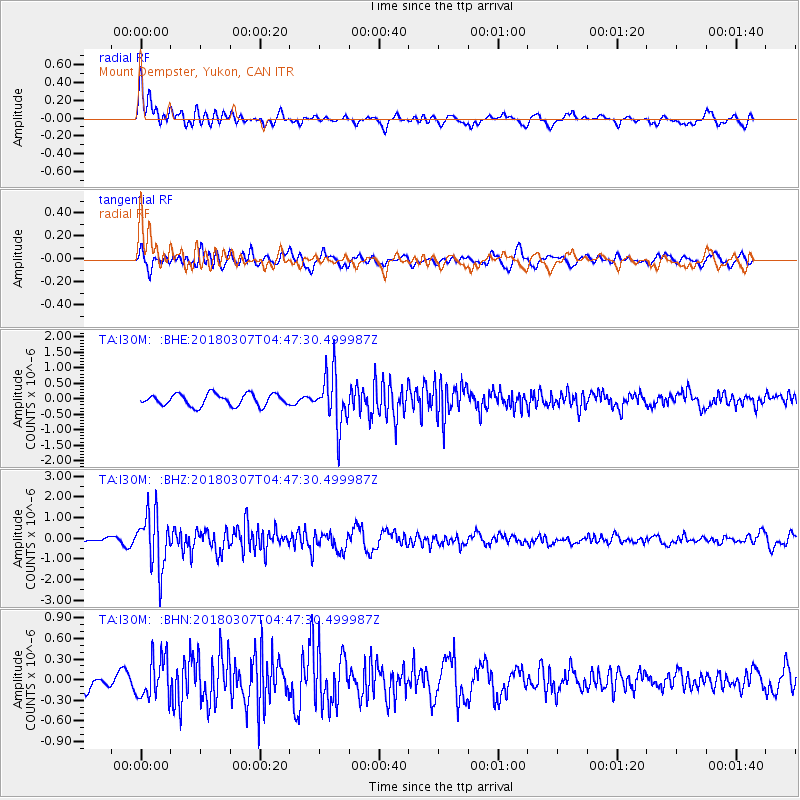
I30M Mount Dempster, Yukon, CAN - Earthquake Result Viewer
*The percent match for this event was below the threshold and hence no stack was calculated.
| Earthquake location: |
East Of Kuril Islands |
| Earthquake latitude/longitude: |
45.8/152.3 |
| Earthquake time(UTC): |
2018/03/07 (066) 04:40:12 GMT |
| Earthquake Depth: |
29 km |
| Earthquake Magnitude: |
5.8 Mww |
| Earthquake Catalog/Contributor: |
NEIC PDE/us |
|
| Network: |
TA USArray Transportable Network (new EarthScope stations) |
| Station: |
I30M Mount Dempster, Yukon, CAN |
| Lat/Lon: |
65.22 N/136.38 W |
| Elevation: |
1399 m |
|
| Distance: |
42.0 deg |
| Az: |
36.594 deg |
| Baz: |
278.441 deg |
| Ray Param: |
$rayparam |
*The percent match for this event was below the threshold and hence was not used in the summary stack. |
|
| Radial Match: |
72.28792 % |
| Radial Bump: |
400 |
| Transverse Match: |
59.77969 % |
| Transverse Bump: |
400 |
| SOD ConfigId: |
13570011 |
| Insert Time: |
2019-04-29 22:24:34.393 +0000 |
| GWidth: |
2.5 |
| Max Bumps: |
400 |
| Tol: |
0.001 |
|
Signal To Noise
| Channel | StoN | STA | LTA |
| TA:I30M: :BHZ:20180307T04:47:30.499987Z | 8.326143 | 1.3210405E-6 | 1.5866175E-7 |
| TA:I30M: :BHN:20180307T04:47:30.499987Z | 1.8312865 | 3.0097854E-7 | 1.6435361E-7 |
| TA:I30M: :BHE:20180307T04:47:30.499987Z | 4.4203196 | 8.405685E-7 | 1.9016011E-7 |
| Arrivals |
| Ps | |
| PpPs | |
| PsPs/PpSs | |


