You are here: Home > Network List > TA - USArray Transportable Network (new EarthScope stations) Stations List
> Station L20K Farewell, AK, USA > Earthquake Result Viewer
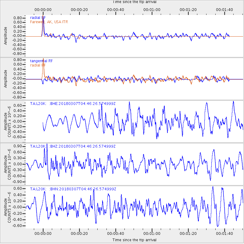
L20K Farewell, AK, USA - Earthquake Result Viewer
*The percent match for this event was below the threshold and hence no stack was calculated.
| Earthquake location: |
East Of Kuril Islands |
| Earthquake latitude/longitude: |
45.8/152.3 |
| Earthquake time(UTC): |
2018/03/07 (066) 04:40:12 GMT |
| Earthquake Depth: |
29 km |
| Earthquake Magnitude: |
5.8 Mww |
| Earthquake Catalog/Contributor: |
NEIC PDE/us |
|
| Network: |
TA USArray Transportable Network (new EarthScope stations) |
| Station: |
L20K Farewell, AK, USA |
| Lat/Lon: |
62.48 N/153.88 W |
| Elevation: |
673 m |
|
| Distance: |
34.4 deg |
| Az: |
41.541 deg |
| Baz: |
266.616 deg |
| Ray Param: |
$rayparam |
*The percent match for this event was below the threshold and hence was not used in the summary stack. |
|
| Radial Match: |
58.108135 % |
| Radial Bump: |
400 |
| Transverse Match: |
41.172207 % |
| Transverse Bump: |
400 |
| SOD ConfigId: |
13570011 |
| Insert Time: |
2019-04-29 22:24:52.394 +0000 |
| GWidth: |
2.5 |
| Max Bumps: |
400 |
| Tol: |
0.001 |
|
Signal To Noise
| Channel | StoN | STA | LTA |
| TA:L20K: :BHZ:20180307T04:46:26.574999Z | 4.129154 | 4.4219402E-7 | 1.07090706E-7 |
| TA:L20K: :BHN:20180307T04:46:26.574999Z | 1.9002331 | 2.6561983E-7 | 1.3978276E-7 |
| TA:L20K: :BHE:20180307T04:46:26.574999Z | 1.5909468 | 2.895142E-7 | 1.8197603E-7 |
| Arrivals |
| Ps | |
| PpPs | |
| PsPs/PpSs | |


