You are here: Home > Network List > US - United States National Seismic Network Stations List
> Station MSO Missoula, Montana, USA > Earthquake Result Viewer
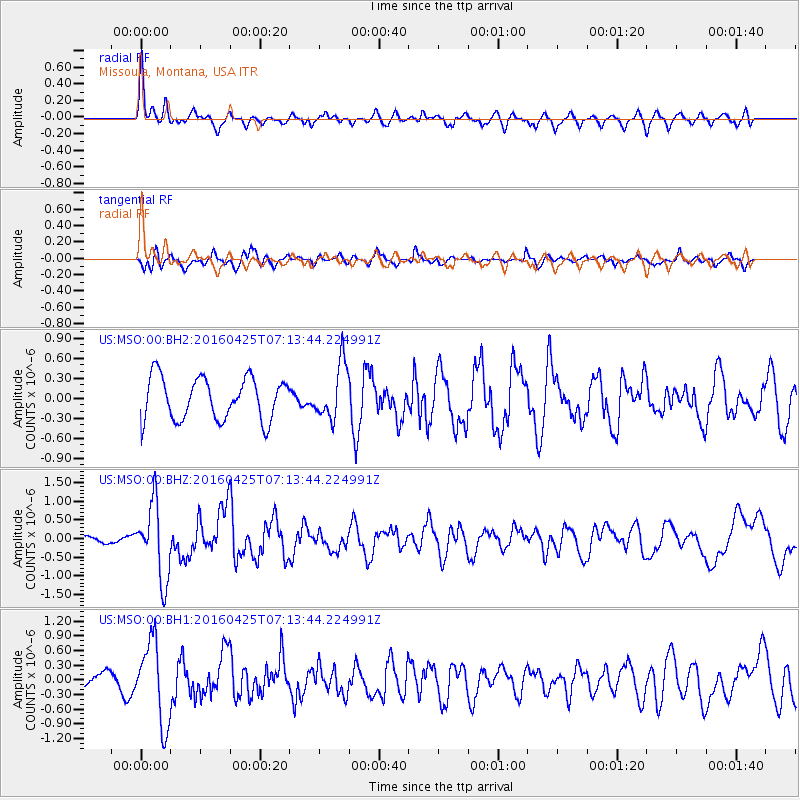
MSO Missoula, Montana, USA - Earthquake Result Viewer
*The percent match for this event was below the threshold and hence no stack was calculated.
| Earthquake location: |
Near Coast Of Chiapas, Mexico |
| Earthquake latitude/longitude: |
14.4/-93.1 |
| Earthquake time(UTC): |
2016/04/25 (116) 07:07:09 GMT |
| Earthquake Depth: |
26 km |
| Earthquake Magnitude: |
5.6 MB |
| Earthquake Catalog/Contributor: |
NEIC PDE/NEIC COMCAT |
|
| Network: |
US United States National Seismic Network |
| Station: |
MSO Missoula, Montana, USA |
| Lat/Lon: |
46.83 N/113.94 W |
| Elevation: |
1264 m |
|
| Distance: |
36.7 deg |
| Az: |
335.892 deg |
| Baz: |
144.802 deg |
| Ray Param: |
$rayparam |
*The percent match for this event was below the threshold and hence was not used in the summary stack. |
|
| Radial Match: |
67.98673 % |
| Radial Bump: |
400 |
| Transverse Match: |
64.701065 % |
| Transverse Bump: |
400 |
| SOD ConfigId: |
1475611 |
| Insert Time: |
2016-05-09 07:13:24.933 +0000 |
| GWidth: |
2.5 |
| Max Bumps: |
400 |
| Tol: |
0.001 |
|
Signal To Noise
| Channel | StoN | STA | LTA |
| US:MSO:00:BHZ:20160425T07:13:44.224991Z | 3.2083979 | 1.0105377E-6 | 3.1496646E-7 |
| US:MSO:00:BH1:20160425T07:13:44.224991Z | 3.9989355 | 8.3710853E-7 | 2.0933285E-7 |
| US:MSO:00:BH2:20160425T07:13:44.224991Z | 1.3089525 | 4.1389384E-7 | 3.1620235E-7 |
| Arrivals |
| Ps | |
| PpPs | |
| PsPs/PpSs | |


