You are here: Home > Network List > TA - USArray Transportable Network (new EarthScope stations) Stations List
> Station M53A WI Miller and Sons, Farmdale, OH, USA > Earthquake Result Viewer
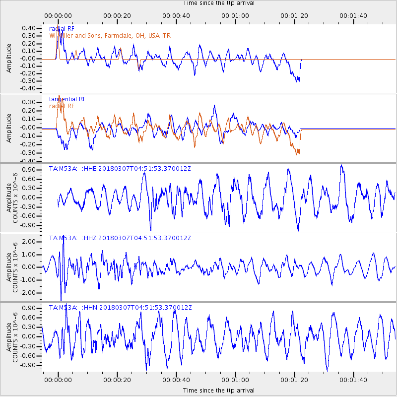
M53A WI Miller and Sons, Farmdale, OH, USA - Earthquake Result Viewer
*The percent match for this event was below the threshold and hence no stack was calculated.
| Earthquake location: |
East Of Kuril Islands |
| Earthquake latitude/longitude: |
45.8/152.3 |
| Earthquake time(UTC): |
2018/03/07 (066) 04:40:12 GMT |
| Earthquake Depth: |
29 km |
| Earthquake Magnitude: |
5.8 Mww |
| Earthquake Catalog/Contributor: |
NEIC PDE/us |
|
| Network: |
TA USArray Transportable Network (new EarthScope stations) |
| Station: |
M53A WI Miller and Sons, Farmdale, OH, USA |
| Lat/Lon: |
41.44 N/80.68 W |
| Elevation: |
334 m |
|
| Distance: |
81.1 deg |
| Az: |
37.408 deg |
| Baz: |
325.599 deg |
| Ray Param: |
$rayparam |
*The percent match for this event was below the threshold and hence was not used in the summary stack. |
|
| Radial Match: |
70.11601 % |
| Radial Bump: |
400 |
| Transverse Match: |
58.42008 % |
| Transverse Bump: |
396 |
| SOD ConfigId: |
13570011 |
| Insert Time: |
2019-04-29 22:25:06.131 +0000 |
| GWidth: |
2.5 |
| Max Bumps: |
400 |
| Tol: |
0.001 |
|
Signal To Noise
| Channel | StoN | STA | LTA |
| TA:M53A: :HHZ:20180307T04:51:53.370012Z | 3.9379454 | 1.1107164E-6 | 2.820548E-7 |
| TA:M53A: :HHN:20180307T04:51:53.370012Z | 0.86824924 | 4.4788848E-7 | 5.1585243E-7 |
| TA:M53A: :HHE:20180307T04:51:53.370012Z | 1.9921921 | 4.719687E-7 | 2.3690922E-7 |
| Arrivals |
| Ps | |
| PpPs | |
| PsPs/PpSs | |


